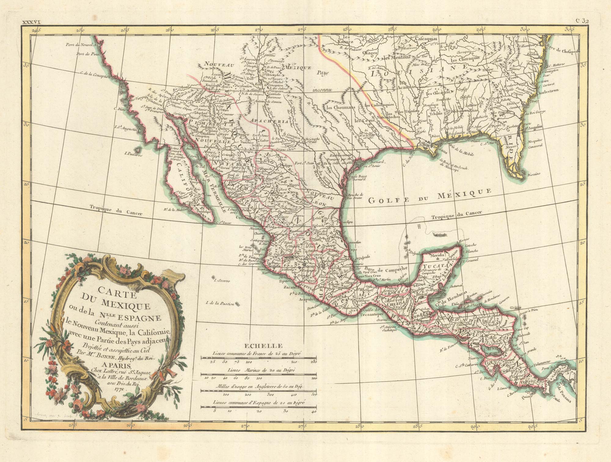


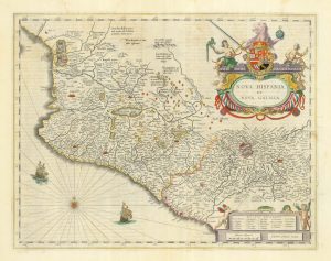
18th century French map of Mexico & Texas
Carte du Mexique ou de la N.lle Espagne Contenant aussi le Nouveau Mexique, la Californie, avec une Partie des Pays adjacents....
Paris: Jean Lattré, 1771. Old colour. 310 x 430mm.
£450.00
1 in stock
x
Question About This Item?
18th century French map of Mexico & Texas & BONNE, Rigobert.Stock #: 25098
Add to Wishlist
Export as PDFEnquireSimilar to Sell?Add to Wishlist
Description
A map of Mexico, but showing North America as far north as Chesapeake Bay and south to Panama, with Baja California and New Mexico including Santa Fé. Also shows good detail in Texas and along the Rio Grande River, Rio Colorado and Gila. A number of early settlements and Indian tribes are shown.The map marks Jesuit Missions and tribal areas.
Condition:
A fine example.Related products
-
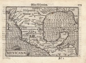
Early edition of this miniature map of Mexico & Texas
LANGENES, Barent. Date: 1599Stock #: 21260 £1,000.00 -
Campeche
ALLARD, Carel. Date: 1720Stock #: 9995 £50.00 -
A 17th century map of central Mexico
BLAEU, Willem Janszoon. Date: 1662Stock #: 22723 £450.00 -

A 16th century map of the colony of New Spain
ORTELIUS, Abraham. Date: 1592Stock #: 25516 £800.00
Items by the same author
Add to Wishlist
Add to Wishlist
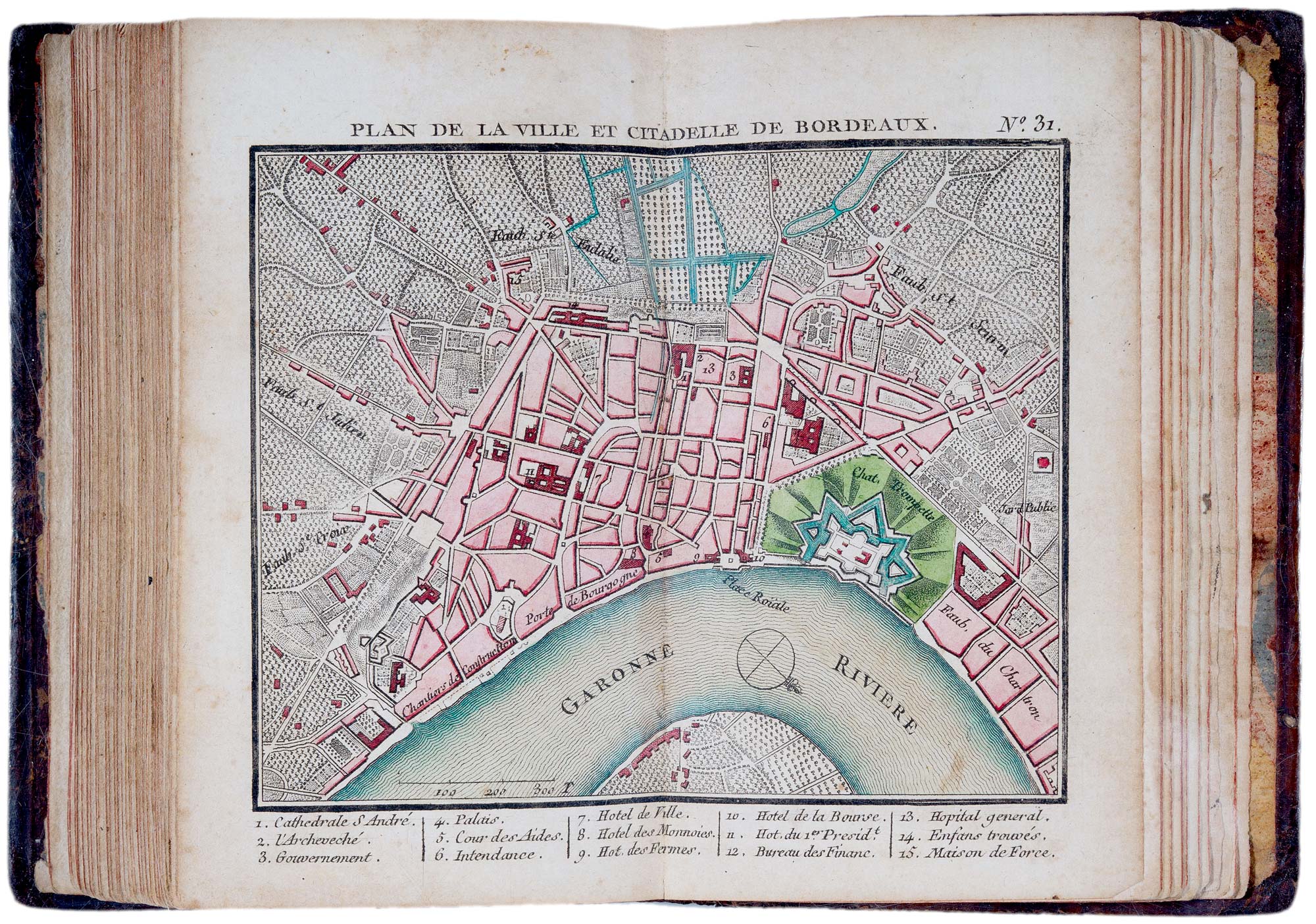
A fine 18th century miniature atlas of the coasts of France
BONNE, Rigobert. Date: 1778 Stock #: 21944 £2,700.00
Add to Wishlist
Add to Wishlist
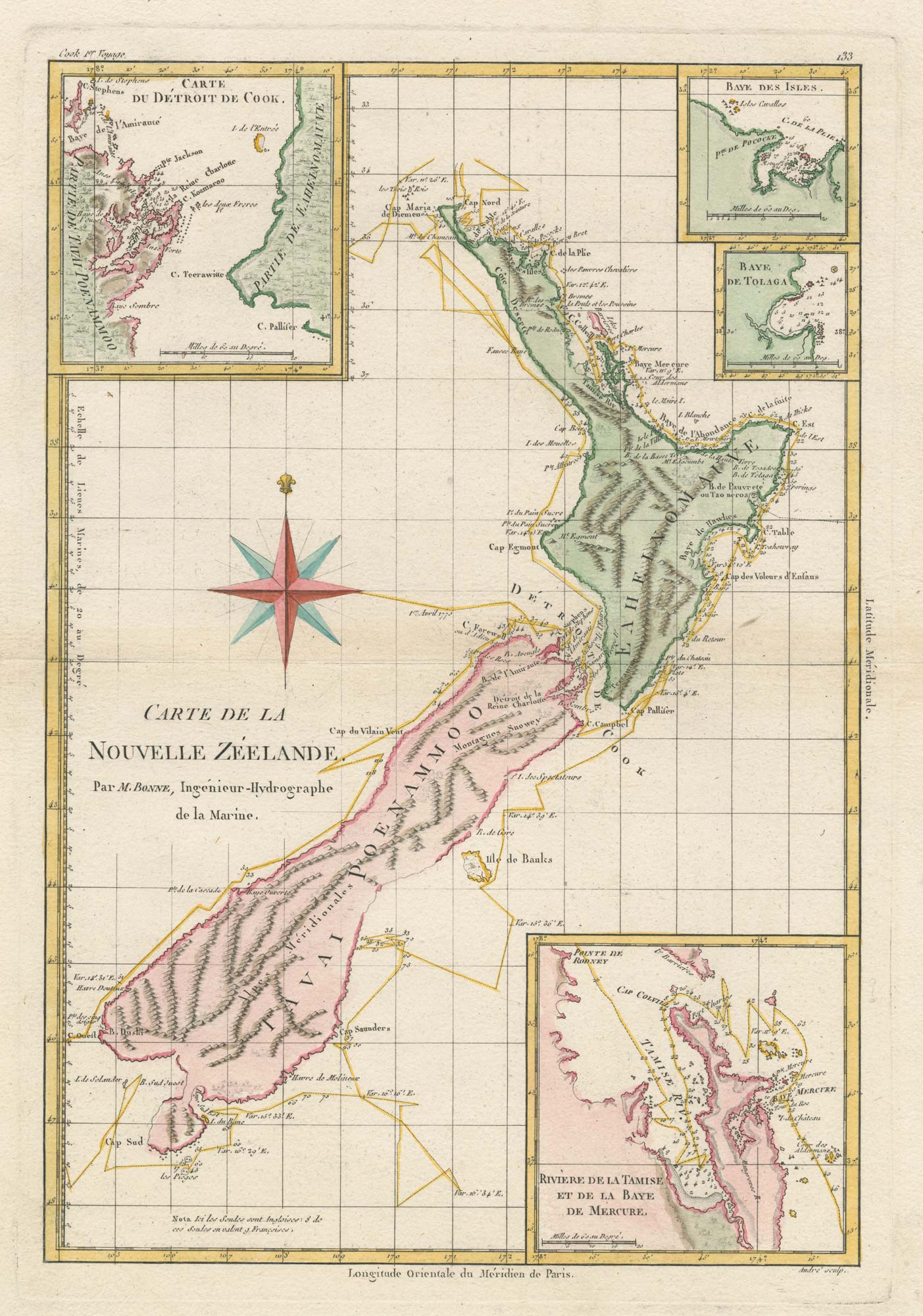
Cook's mapping of New Zealand
BONNE, Rigobert. Date: 1778 Stock #: 19641 £750.00
Add to Wishlist
Add to Wishlist

Extremely rare Russian edition of Bonne's map of Europe
BONNE, Rigobert. Date: 1793 Stock #: 20509 £500.00
Add to Wishlist
Add to Wishlist

Extremely rare Russian edition of Bonne's map of South America
BONNE, Rigobert. Date: 1793 Stock #: 20510 £650.00
Add to Wishlist
Add to Wishlist