

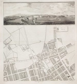
A plan of Covent Garden at the end of the 17th century
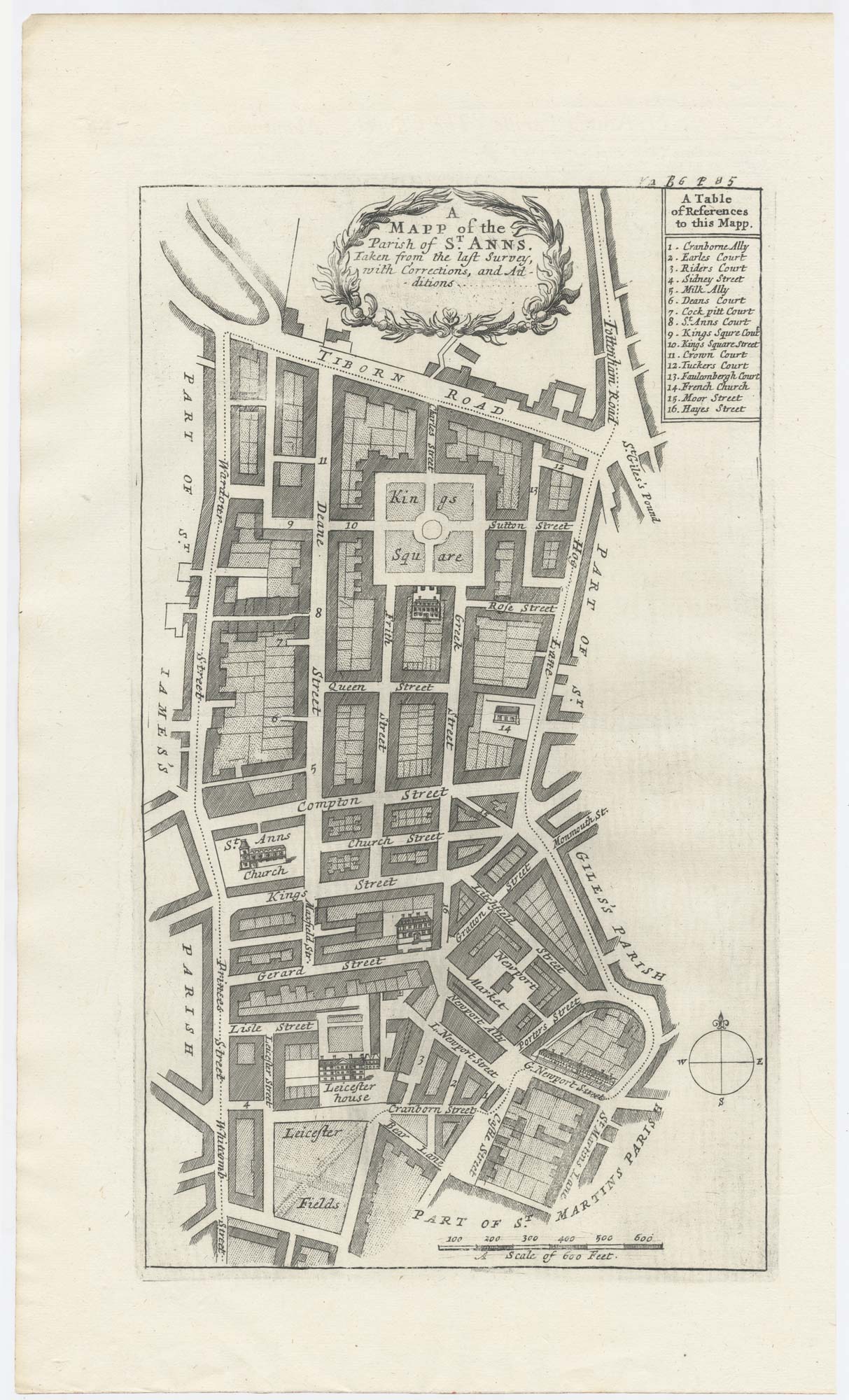
A Mapp of the Parish of St Anns. Taken from the last Survey, with corrections and Additions
London: Awnsham Churchill, John Knapton et al, 1720. 315 x 190mm.
£400.00
1 in stock
x
Question About This Item?
A plan of Covent Garden at the end of the 17th century & BLOME, Richard.Stock #: 25282
Add to Wishlist
Export as PDFEnquireSimilar to Sell?Add to Wishlist
Description
A fine example of the first printed map to focus on Soho, engraved by Richard Blome c.1695 but not published until 1720, with his name removed from the title, leaving traces of engraving.
The map depicts the Parish of 'St Anne Within the Liberty of Westminster', which was created in 1687 and named for Princess (later queen) Anne. The parish extends to 'Tiborn Road' (Oxford Street) at the top, to Wardour Street and Whitcomb Street in the west, Leicester Fields in the south and 'Hog Lane' (Charing Cross Road) and St Martin's Lane in the east. Soho Square appears as 'Kings Square' and Leicester House is shown as an elevation.
In 1695 William III granted Blome a privilege to publish 'A Survey or description of the citties of London and Westminstr'. Although a few of the parish maps with Blome's name exist in the British Library, the series was not published until John's Strype's 'A Survey of the Cities of London and Westminster', a continuation of 'Stow's Survey'. This example comes from the first edition, with no apparent attempt to update Blome's mapping.
Condition:
A good example.Related products
-
A detailed plan of Kensington Gardens and Hyde Park
ORDNANCE SURVEY. Date: 1944Stock #: 24529 £750.00 -
A plan to redevelop St Martin’s Lane and Monmouth Street
ARROWSMITH, Aaron. Date: 1826Stock #: 21683 £350.00 -
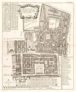
Plan of St James’s Parish at the end of the 17th century
BLOME, Richard. Date: 1720Stock #: 25160 £450.00 -
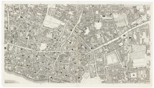
The City and Whitechapel from an important large-scale survey of London
HORWOOD, Richard. Date: 1799Stock #: 18463 £1,250.00 -
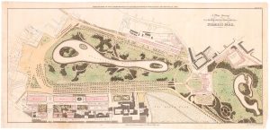
John Nash’s proposed improvements to St James’s Park.
BASIRE, James. Date: 1731Stock #: 23951 £1,100.00 -
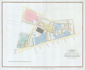
Nash’s plan to redevelop Charing Cross
ARROWSMITH, Aaron. Date: 1826Stock #: 21685 £400.00 -
A detailed plan of Fitzrovia with a view of the ‘New Road’
HORWOOD, Richard. Date: 1794Stock #: 16924 £750.00 -
Covent Garden and Soho from an important large-scale survey of London
HORWOOD, Richard. Date: 1799Stock #: 24405 £1,600.00 -
A detailed plan of Tower Street Ward
STOW, John. Date: 1720Stock #: 22004 £200.00
Items by the same author
Add to Wishlist
Add to Wishlist
A plan of Covent Garden at the end of the 17th century
BLOME, Richard. Date: 1720 Stock #: 25170 £200.00
Add to Wishlist
Add to Wishlist
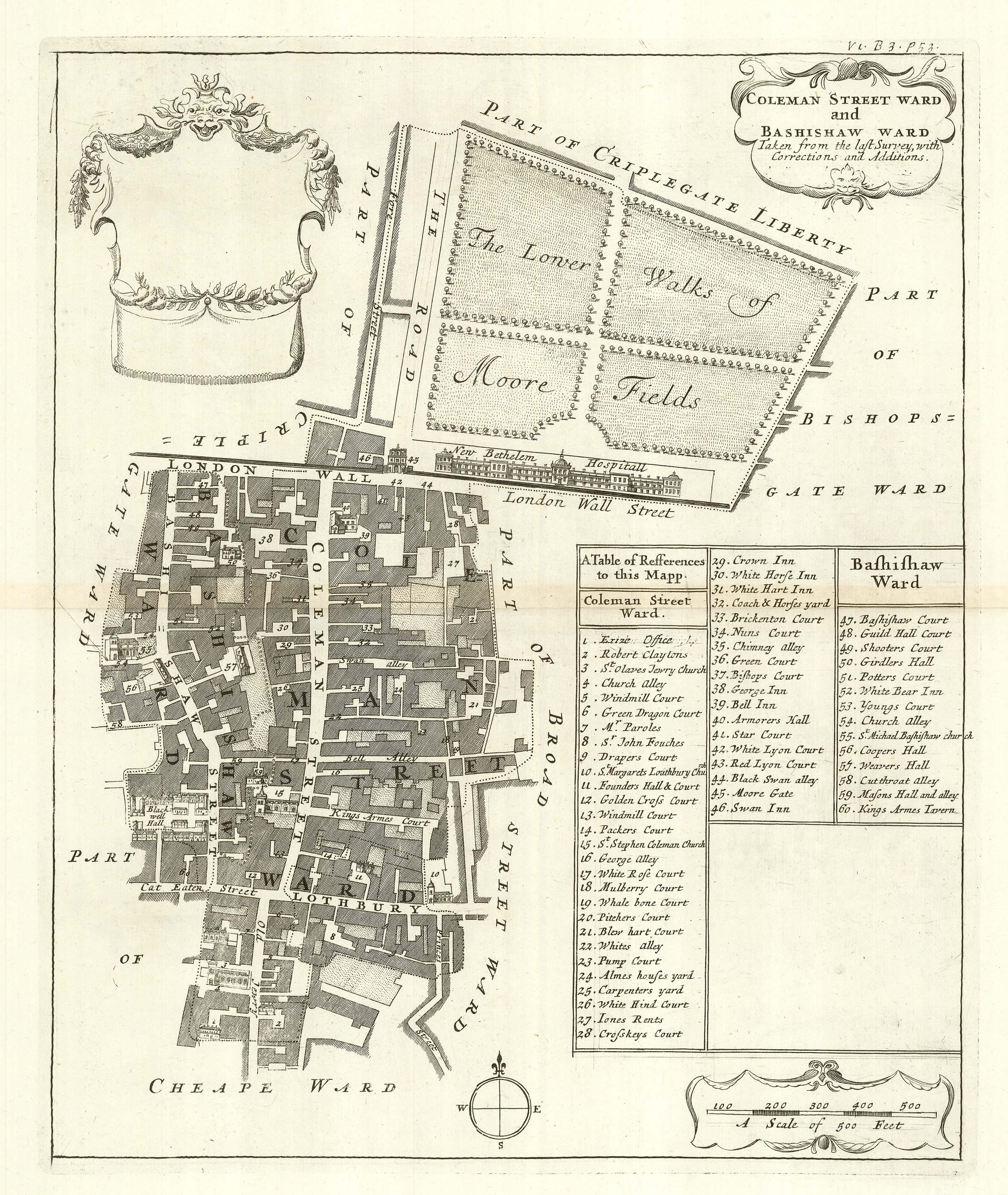
The wards of Coleman Street and Bassishaw at the end of the 17th century
BLOME, Richard. Date: 1720 Stock #: 25162 £200.00
Add to Wishlist
Add to Wishlist
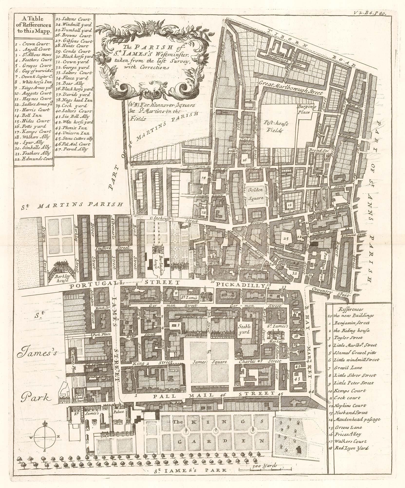
Plan of St James's Parish at the end of the 17th century
BLOME, Richard. Date: 1720 Stock #: 25160 £450.00
Add to Wishlist
Add to Wishlist
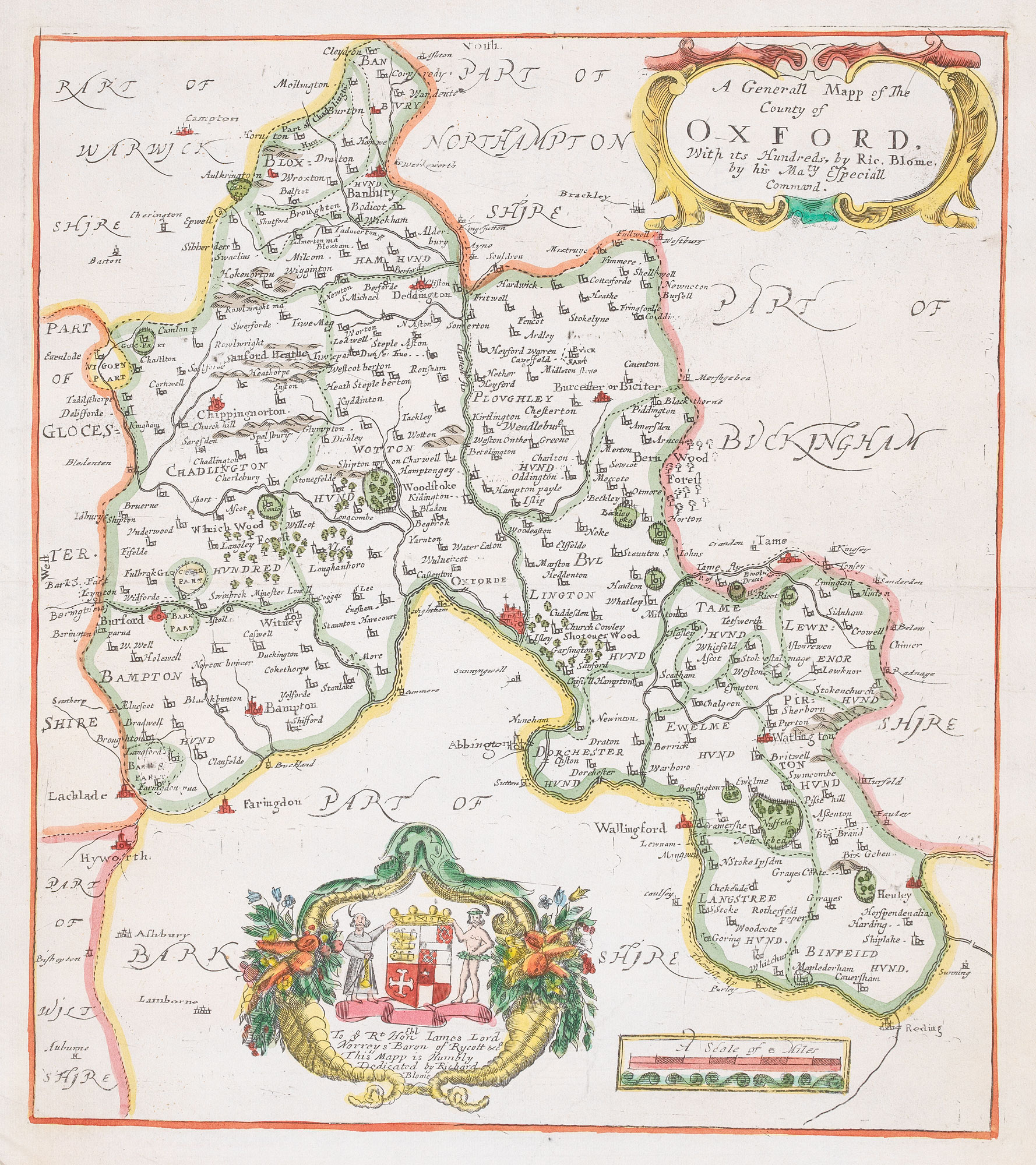
17th century map of Oxfordshire
BLOME, Richard. Date: 1818 Stock #: 20421 £320.00
Add to Wishlist
Add to Wishlist
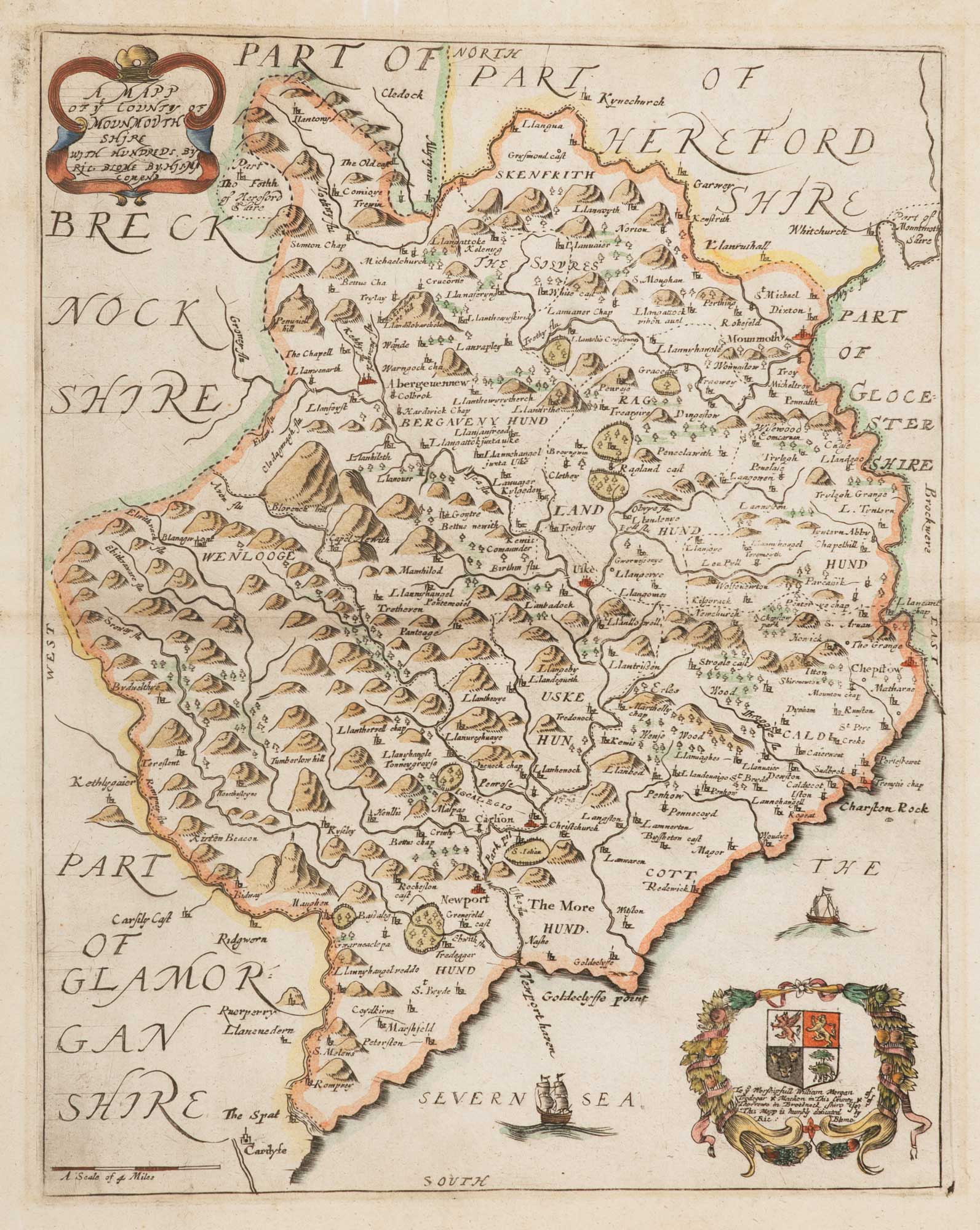
17th century map of Monmouthshire
BLOME, Richard. Date: 1818 Stock #: 15709 £140.00
Add to Wishlist
Add to Wishlist