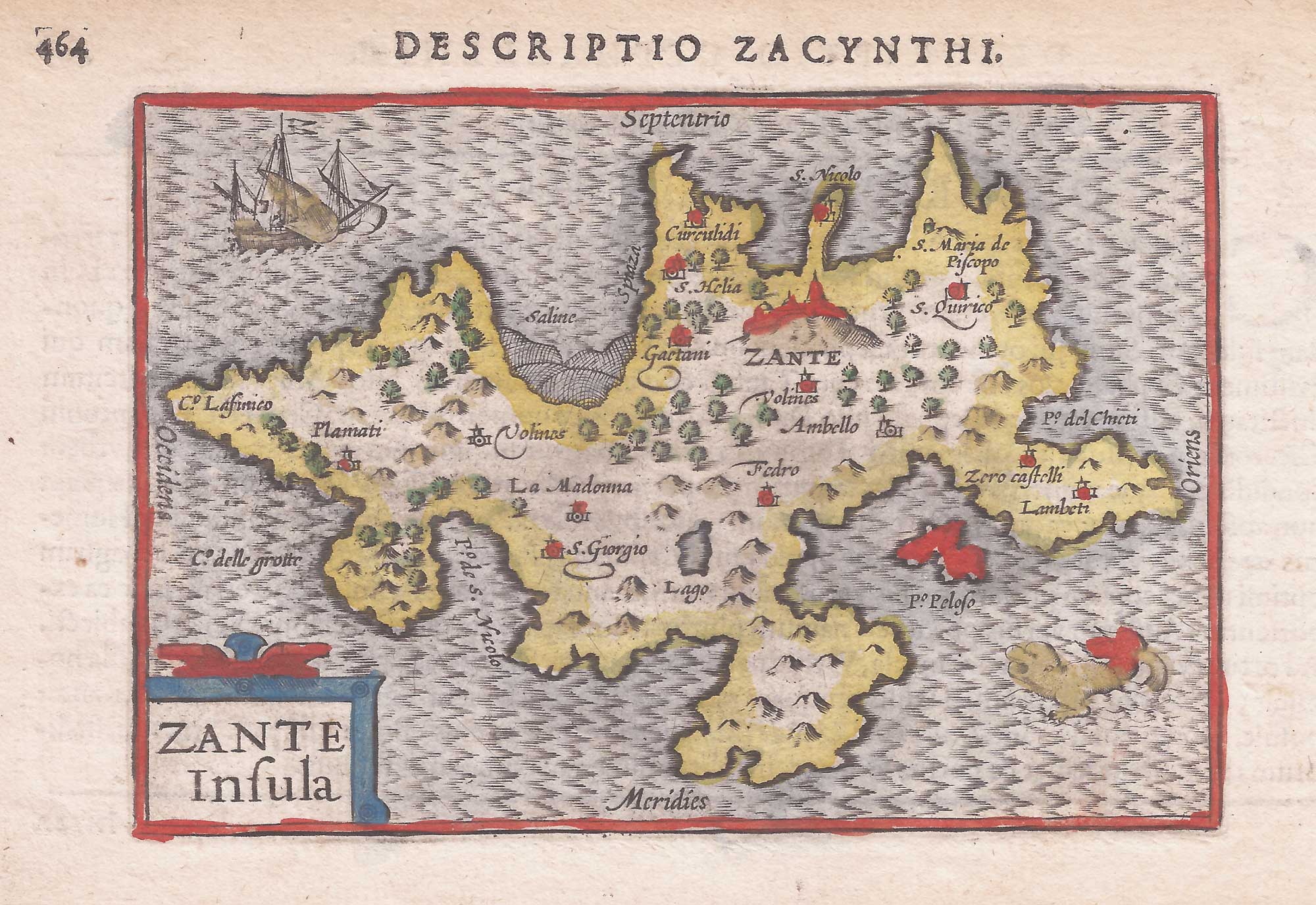


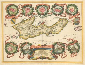
A minature map of Zante
Zante Insula.
Amsterdam, 1602 or 1606. Original colour. 85 x 125mm, with letterpress sur-title.
£200.00
Description
A scarce map of Zante, with a galley and seamonster. It was engraved by either Jodocus Hondius or Pieter van der Keere for the 'Caert-Thresoor' by Langenes in 1598, but this example was published in the 'Tabularum Geographicarum Contractarum' with a text by Petrus Bertius.
In 1616 a new plate was engraved by Jodocus Hondius II, slightly larger and with wider borders with scales of longitude and latitude.
Condition:
A good example.References:
ZACHARAKIS: 1217.Related products
-
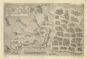
Rare town-plan of Corfu under siege by the Ottomans
WIERING, Thomas von. Date: 1716Stock #: 23665 £340.00 -
An early map of Corfu
BERTELLI, Donato. Date: 1713Stock #: 21940 £350.00 -
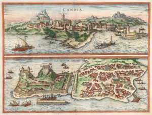
16th century prospect of Corfu & Candia
BRAUN, Georg & HOGENBERG, Frans. Date: 1575Stock #: 20279 £750.00 -
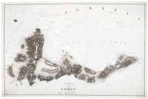
A 19th century manuscript map of Corfu as a British protectorate
Anonymous. Date: 1825Stock #: 19390 £8,500.00 -
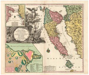
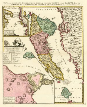
18th century map of Corfu in full original colour
SEUTTER, Matthaus. Date: 1730Stock #: 20403 £1,350.00 -
A large and decorative map of Corfu
CORONELLI, Vincenzo Maria. Date: 1690Stock #: 24095 £750.00 -
A 16th century town plan of Corfu City
VALEGIO, Francesco. Date: 1598Stock #: 24181 £250.00 -
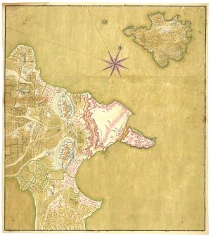
Manuscript map of the defences of Corfu City
Anonymous. Date: 1797Stock #: 24736 £980.00 -
18th century map of Corfu in fine colour
OTTENS, Joachim. Date: 1700Stock #: 24733 £1,350.00
Items by the same author
Add to Wishlist
Add to Wishlist
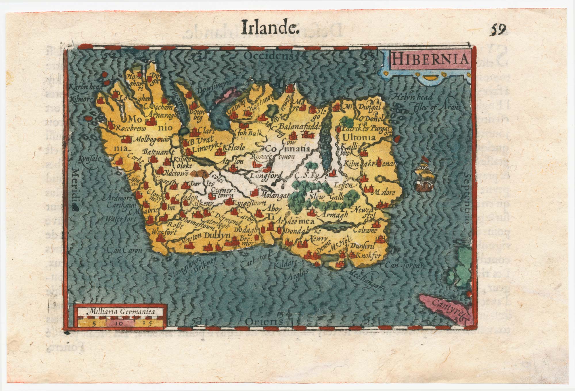
Early 17th century miniature map of Ireland
BERTIUS, Petrus. Date: 1609 Stock #: 24845 £240.00
Add to Wishlist
Add to Wishlist
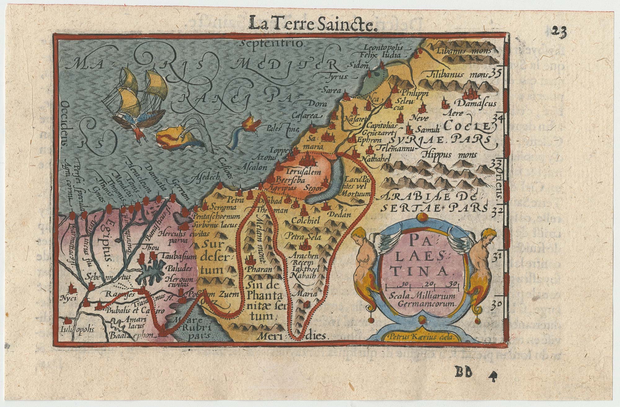
A minature map of the Holy Land
BERTIUS, Petrus. Date: 1609 Stock #: 24848 £200.00
Add to Wishlist
Add to Wishlist
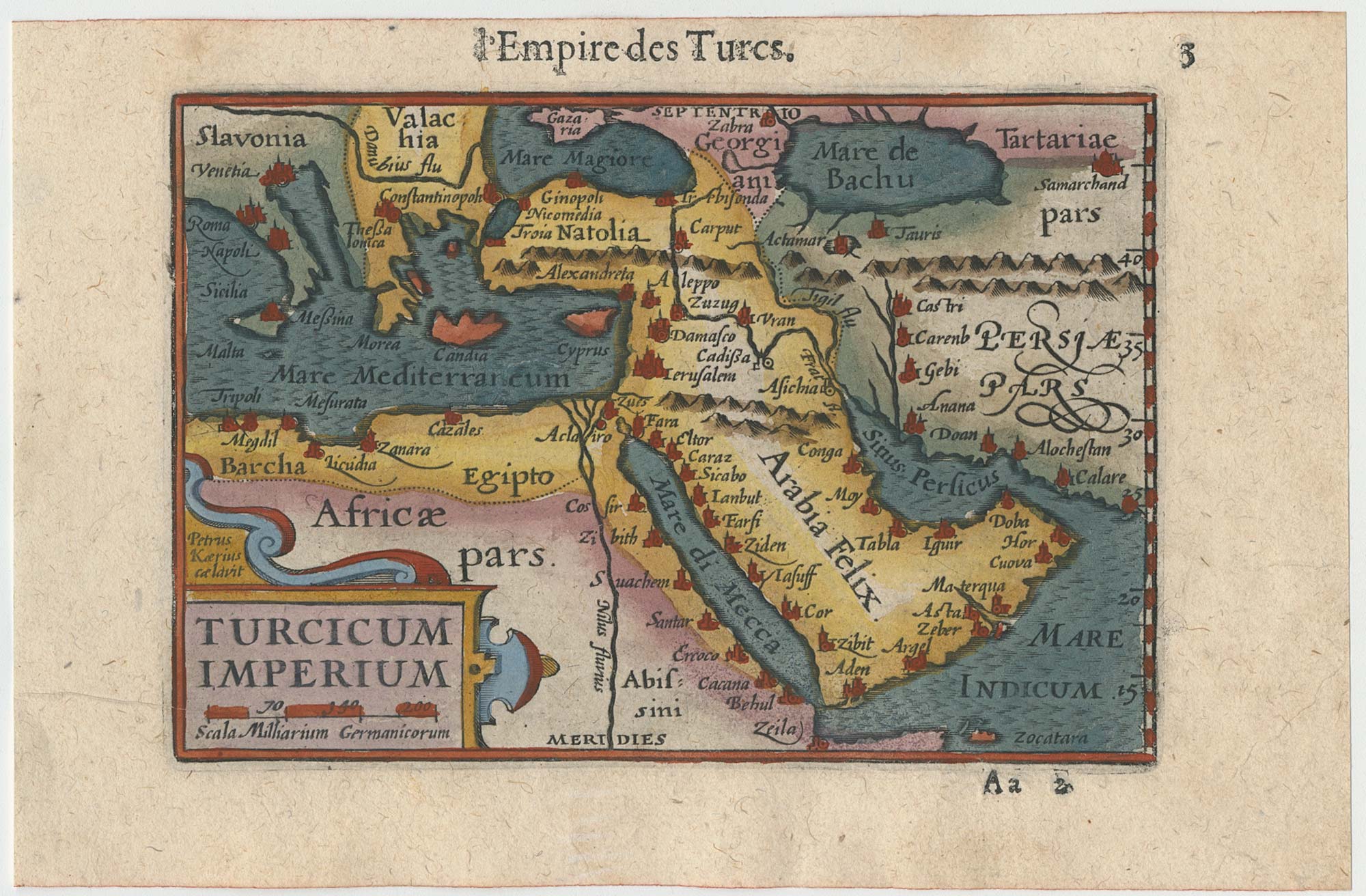
Early 17th century miniature map of the Turkish Empire
BERTIUS, Petrus. Date: 1609 Stock #: 24846 £250.00
Add to Wishlist
Add to Wishlist
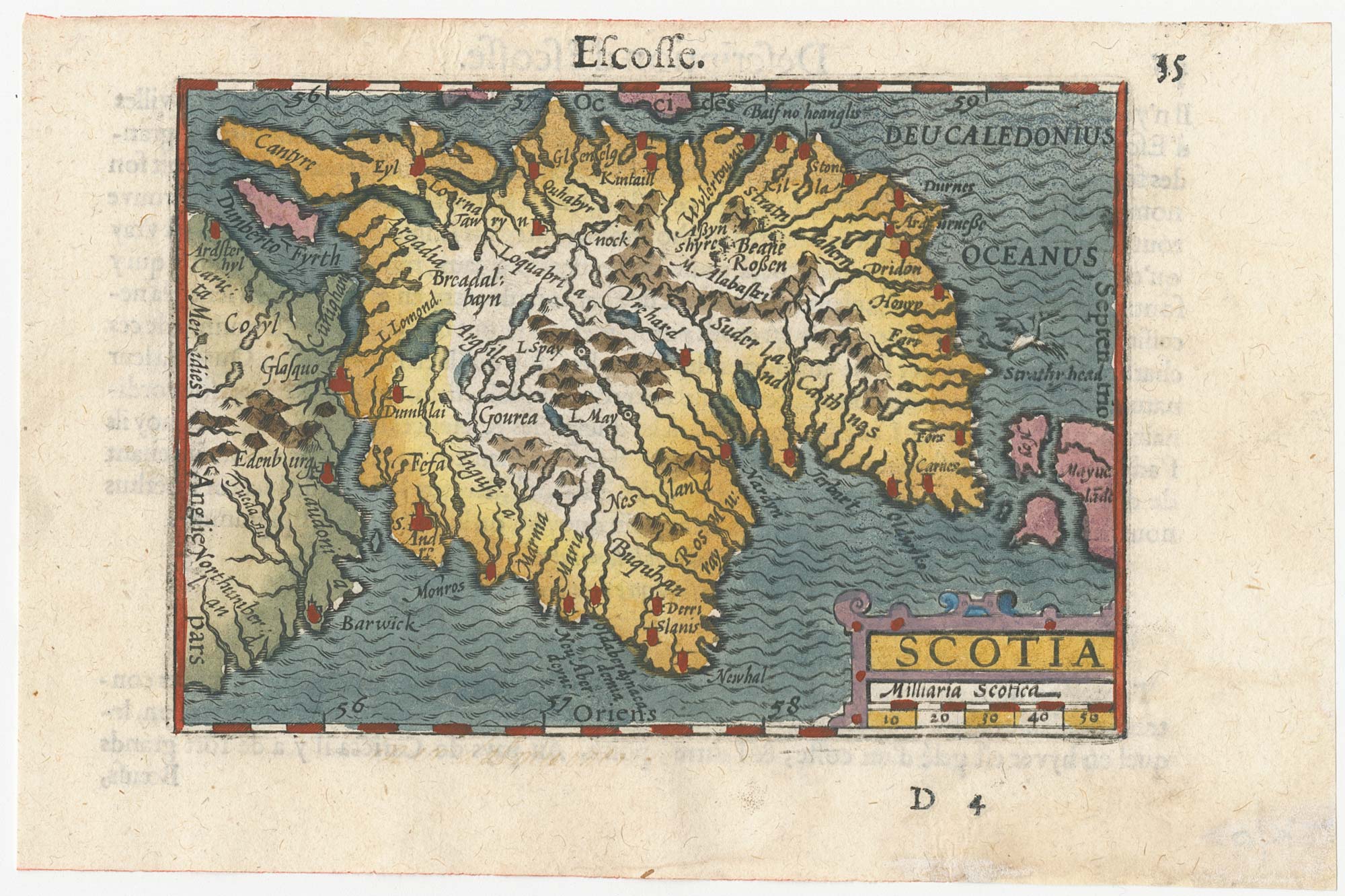
A minature map of Scotland
BERTIUS, Petrus. Date: 1609 Stock #: 24847 £250.00
Add to Wishlist
Add to Wishlist
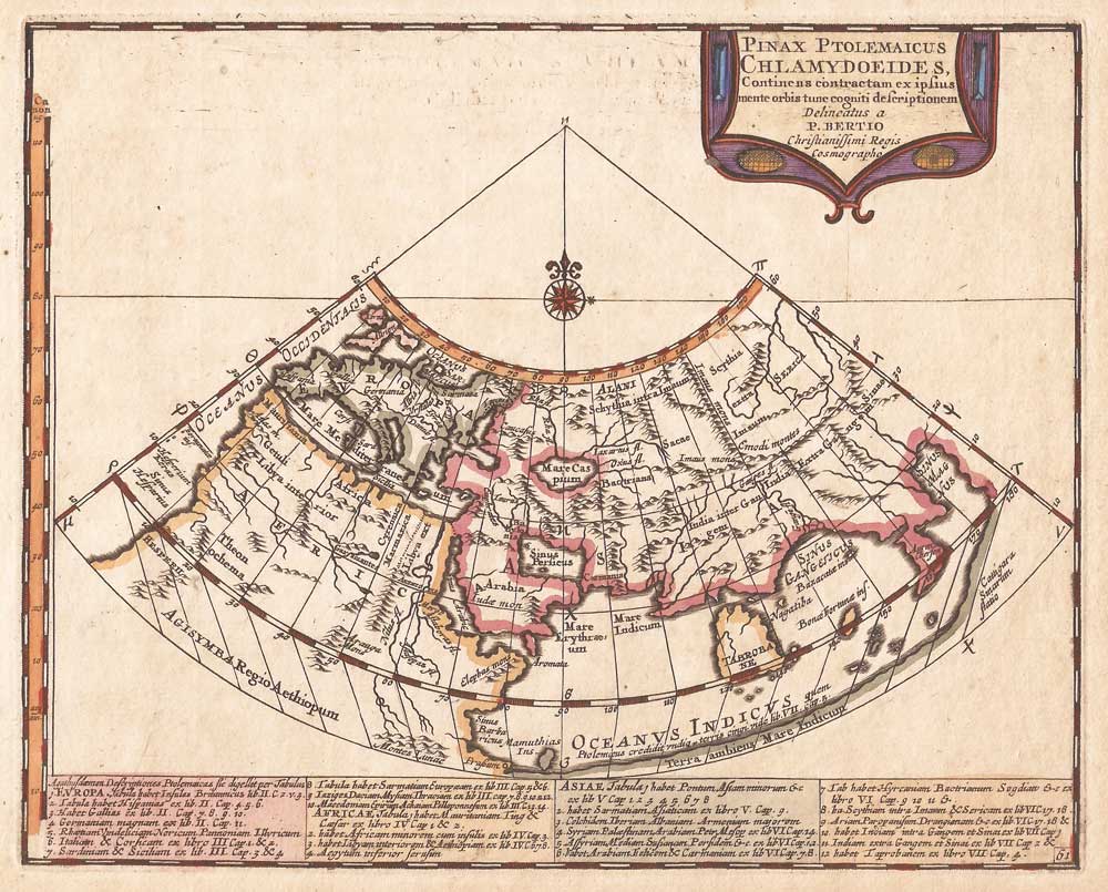
An uncommon Ptolemaic world map
BERTIUS, Petrus. Date: 1696 Stock #: 21189 £300.00
Add to Wishlist
Add to Wishlist