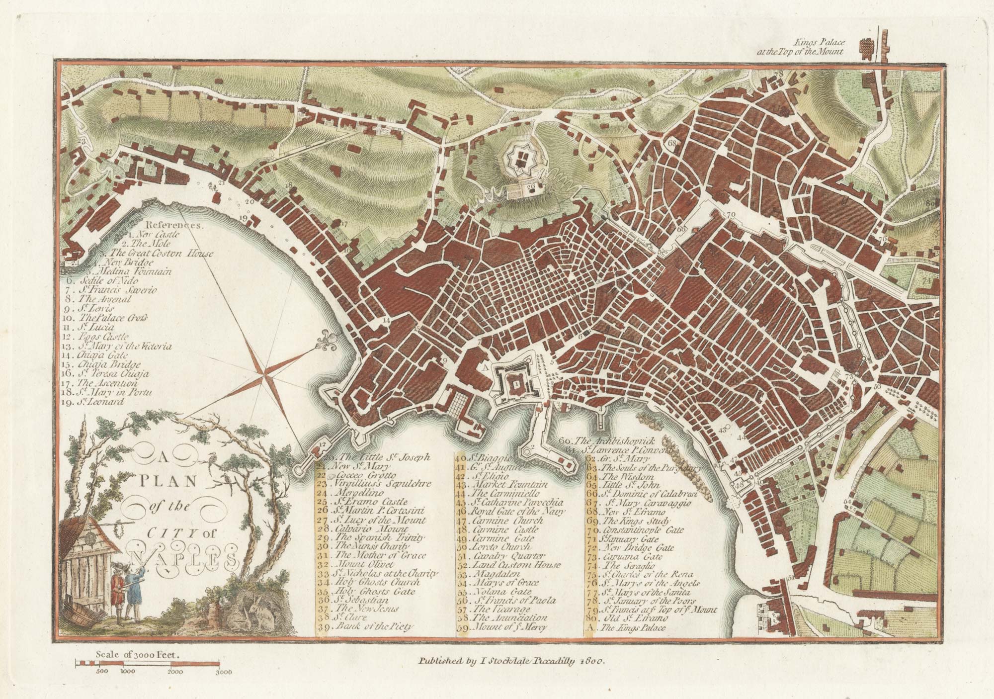
A late-18th century plan of Vienna
A Plan of the City of Vienna.
London, John Stockdale, 1800. Coloured. 180 x 255mm.
£230.00
Description
A plan of Vienna with a 45-point key, published in Andrews' 'A Collection of Plans of the Most Capital Cities of every Empire, Kingdom, Republic and Electorate in Europe and some Remarkable Cities in the other Three Parts of the World'.
This work was first published in 1772, but this example is from an 1800 edition, issued during the Napoleonic Wars.
Condition:
A good example.Related products
-

A 16th century town plan of Vienna
VALEGIO, Francesco. Date: 1598Stock #: 24172 £200.00 -

Two-sheet map of Austria
JAILLOT, Alexis-Hubert. Date: 1705Stock #: 8270 £350.00 -

A scarce plan of Innsbruck with vignettes
TEPLY, Josef. Date: 1840Stock #: 21208 £750.00 -

A two-sheet woodcut prospect of Vienna in the 16th century
MUNSTER, Sebastian. Date: 1548Stock #: 22492 £550.00 -

A 17th century map of Austria
HONDIUS, Jodocus II. Date: 1635Stock #: 23746 £350.00 -

A 17th century map of Austria
JANSSON, Jan. Date: 1650Stock #: 20320 £400.00 -

Ortelius’s map of the province of Salzburg, in fine colour
ORTELIUS, Abraham. Date: 1612Stock #: 23808 £600.00 -

An 18th century playing-card map of Austria
RABATTA, Augusto & BAILOU, Jean Baptist de. Date: 1779Stock #: 12961 £150.00 -

Panorama of Vienna under siege by the Ottomans
SUTTINGER, Daniel. Date: 1683Stock #: 13748 £800.00
Items by the same author
Add to Wishlist
Add to Wishlist

A late-18th century plan of Berlin
ANDREWS, John. Date: 1800 Stock #: 24513 £260.00
Add to Wishlist
Add to Wishlist

A late-18th century plan of Cologne
ANDREWS, John. Date: 1800 Stock #: 22601 £140.00
Add to Wishlist
Add to Wishlist

A late-18th century plan of Munich
ANDREWS, John. Date: 1800 Stock #: 22659 £170.00
Add to Wishlist
Add to Wishlist

A late-18th century plan of Genoa during the Ligurian Republic
ANDREWS, John. Date: 1800 Stock #: 22598 £150.00
Add to Wishlist
Add to Wishlist
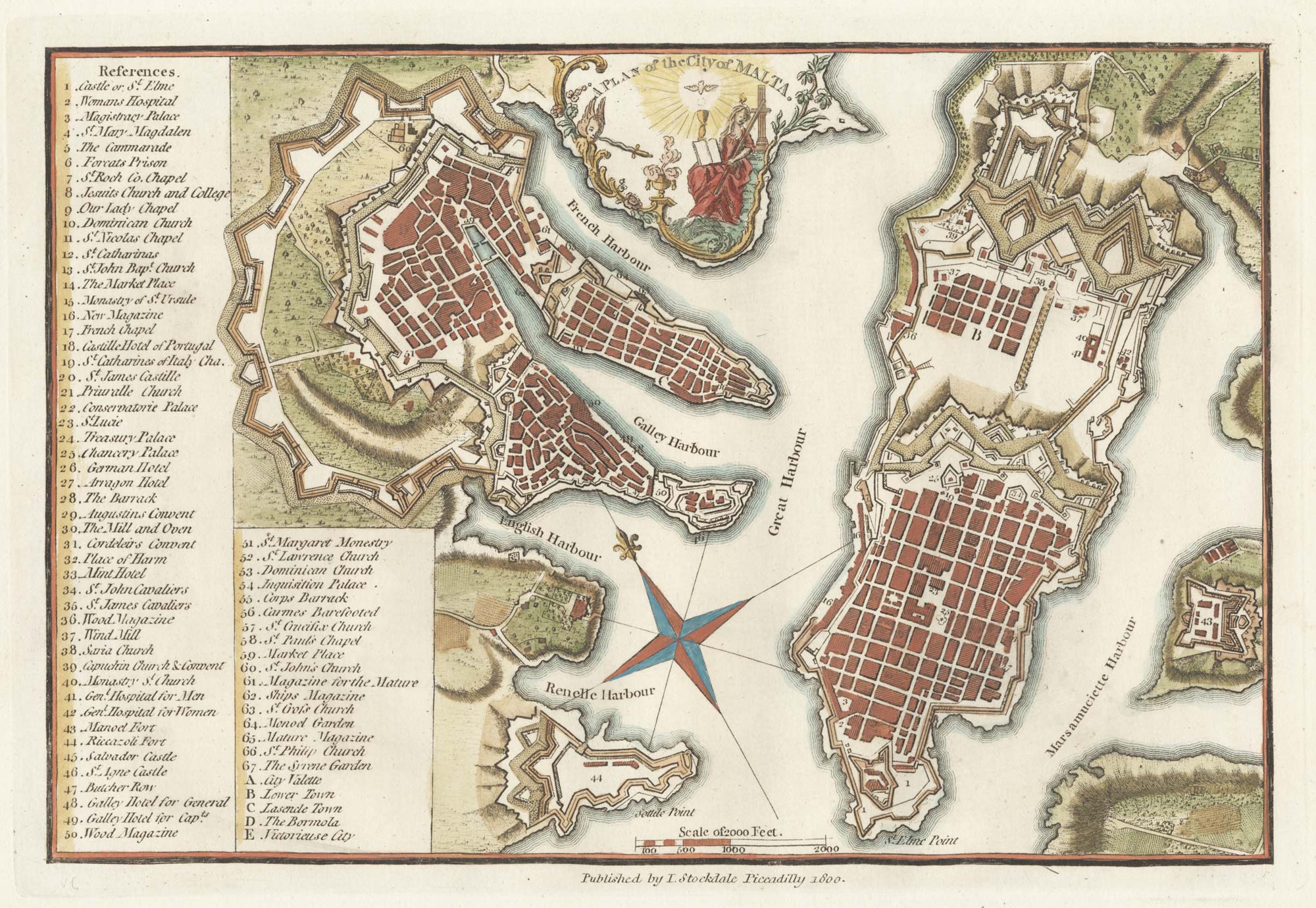
A late-18th century plan of Valletta
ANDREWS, John. Date: 1800 Stock #: 22602 £280.00
Add to Wishlist
Add to Wishlist