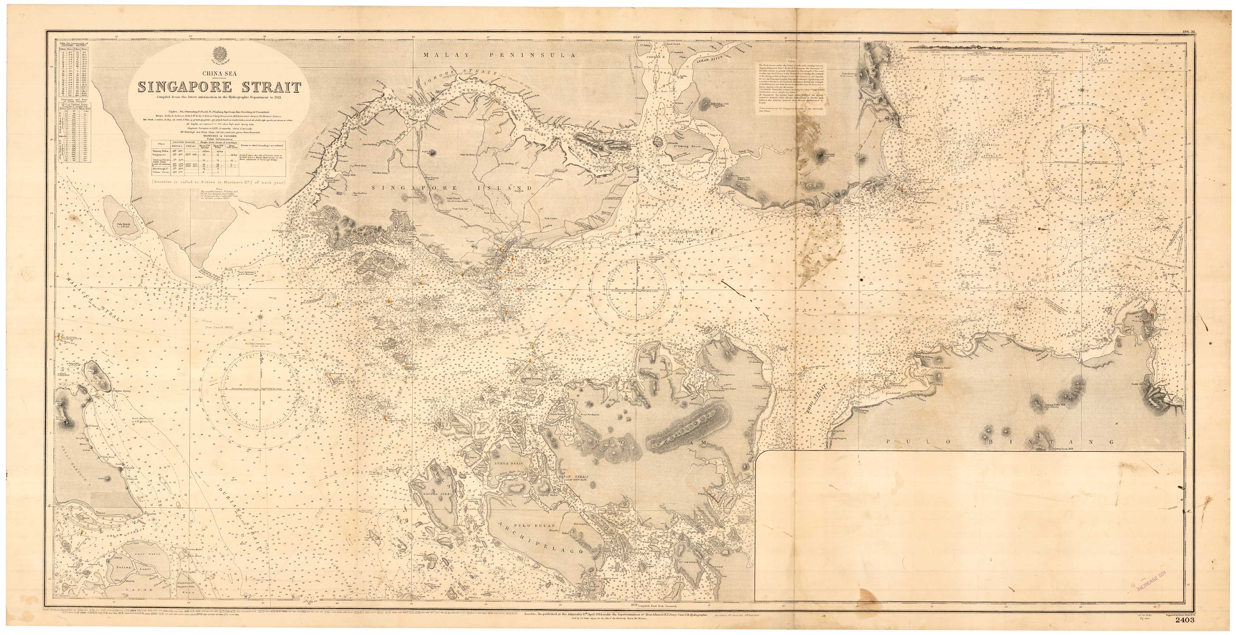


A detailed sea chart of Singapore
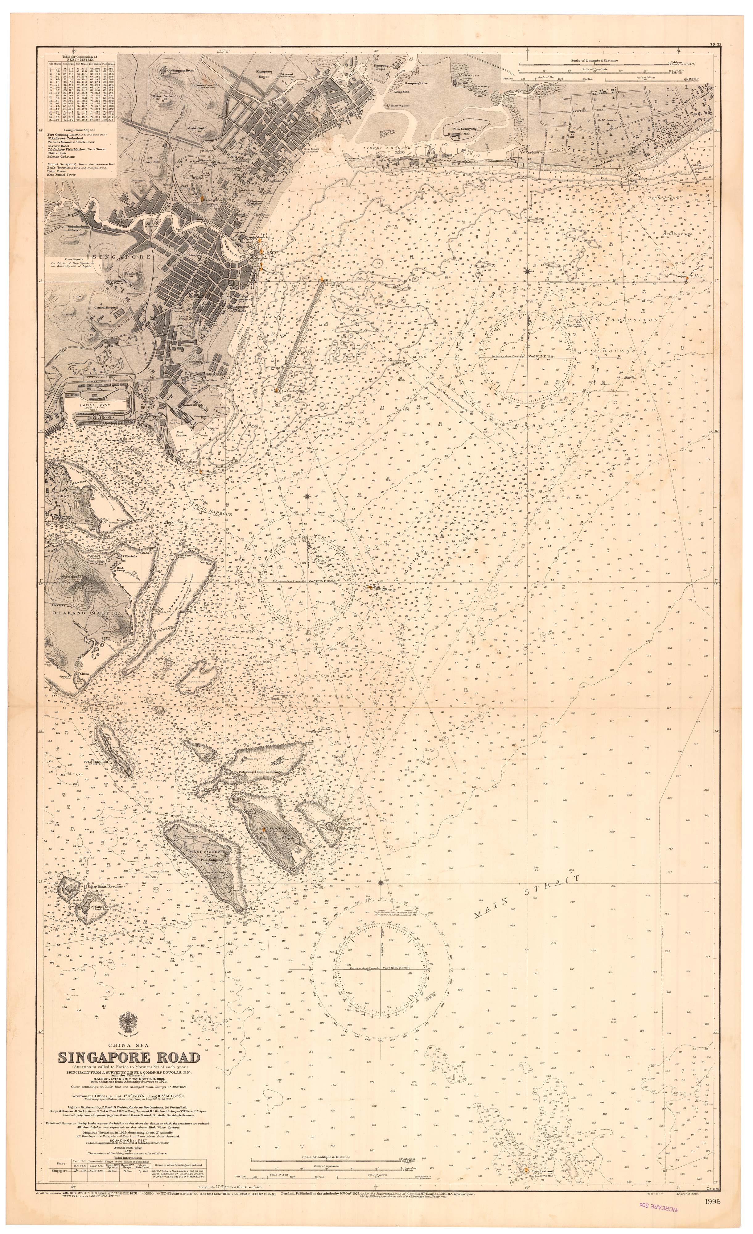
Singapore Road. Principally from a Survey by Lieut. & Comm.r H.P. Douglas, R.N., and the Officers of H.M. Surveying Ship ''Waterwitch", 1909. With Additions from Admiralty Surveys to 1924.
London: 1925-1931. Touches of original colour. 1170 x 710mm.
£3,000.00
Description
A large and detailed sea chart of the eartern approaches to Singapore, with the streets of the city. Touches of colour mark the lighthouses.
Condition:
Chart seller's ink stamps, a few stains.Related products
-
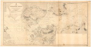
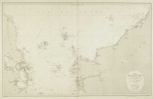
A detailed sea chart of the Singapore Strait
BRITISH ADMIRALTY. Date: 1931Stock #: 22929 £2,600.00 -
A 16th century miniature map of the Malay Peninsula
LANGENES, Barent. Date: 1599Stock #: 21268 £300.00 -
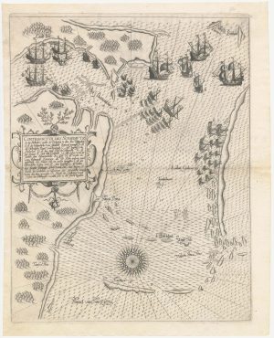
The first European map of Singapore
DE BRY, Theodore. Date: 1603Stock #: 23471 £6,500.00 -
Sea chart of the South China Sea
DE LORENZO, J. Date: 1864Stock #: 12457 £750.00 -
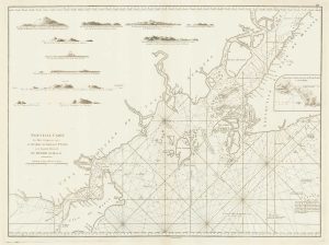
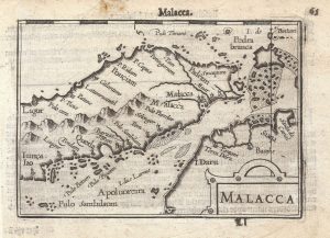
A sea chart of the environs of Singapore
APRÈS DE MANNEVILLETTE, Jean Baptiste d'. Date: 1775Stock #: 19834 £2,000.00 -
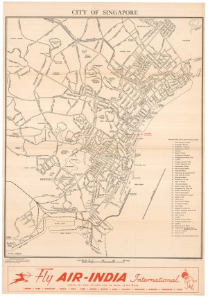
Scarce town plan of Singapore in the 1950s
FEDERATION OF MALAYA SURVEY DEPT. Date: 1953Stock #: 23955 £1,200.00 -
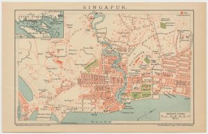
Miniature plan of Singapore
BROCKHAUS, F. A.. Date: 1663Stock #: 24697 £240.00 -

One of the first views of Singapore by a professional artist
DANIELL, William. Date: 1830Stock #: 20043 £4,000.00
Items by the same author
Add to Wishlist
Add to Wishlist