Antique Maps by SAXTON, Christopher.
Showing 1–6 of 6 products
Sort by:
Add to Wishlist
Add to Wishlist
A leaf of Saxton's 'Traveller's Guide' of England and Wales
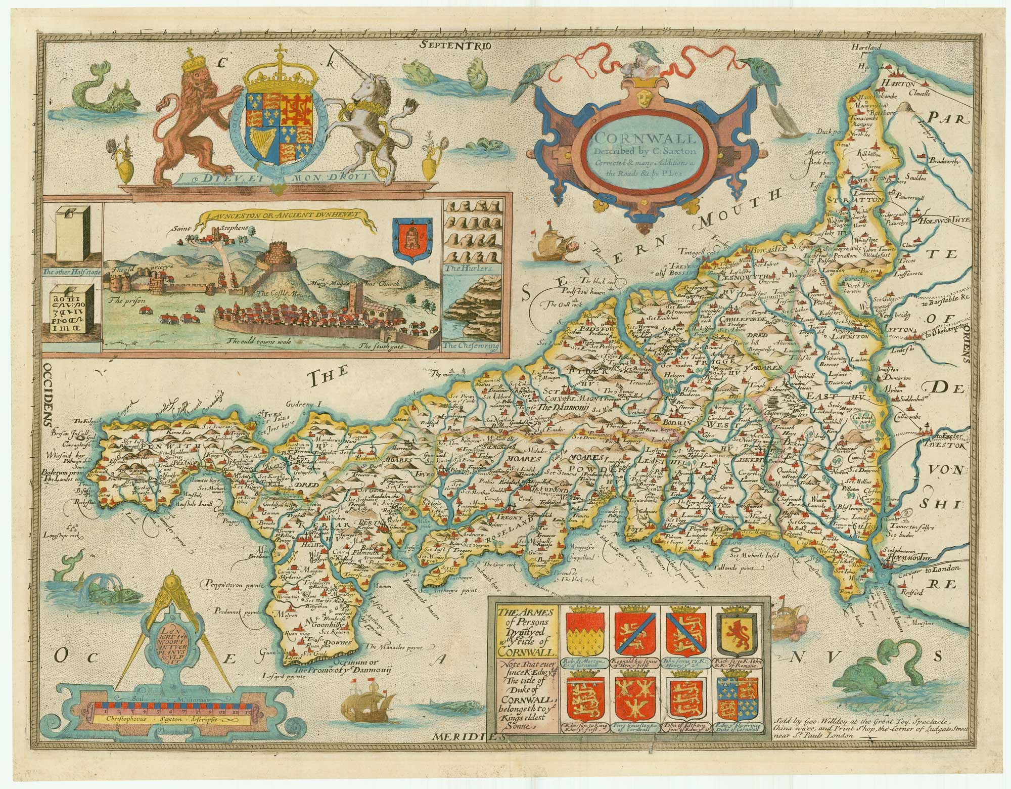
SAXTON, Christopher. Date: 1700 Stock #: 24050 £900.00
Add to Wishlist
Add to Wishlist
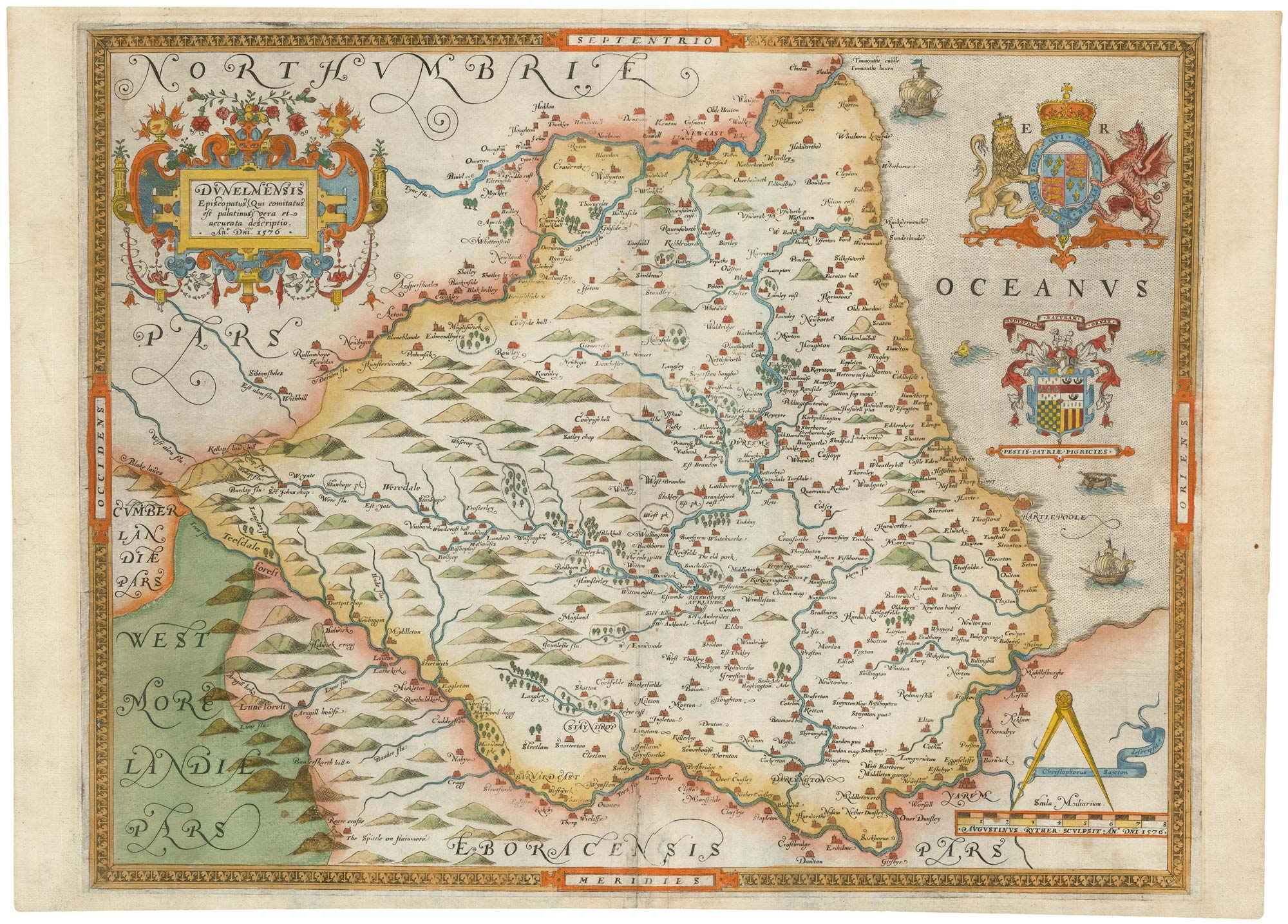
The first printed map of County Durham
SAXTON, Christopher. Date: 1579 Stock #: 22583 £3,000.00
Add to Wishlist
Add to Wishlist
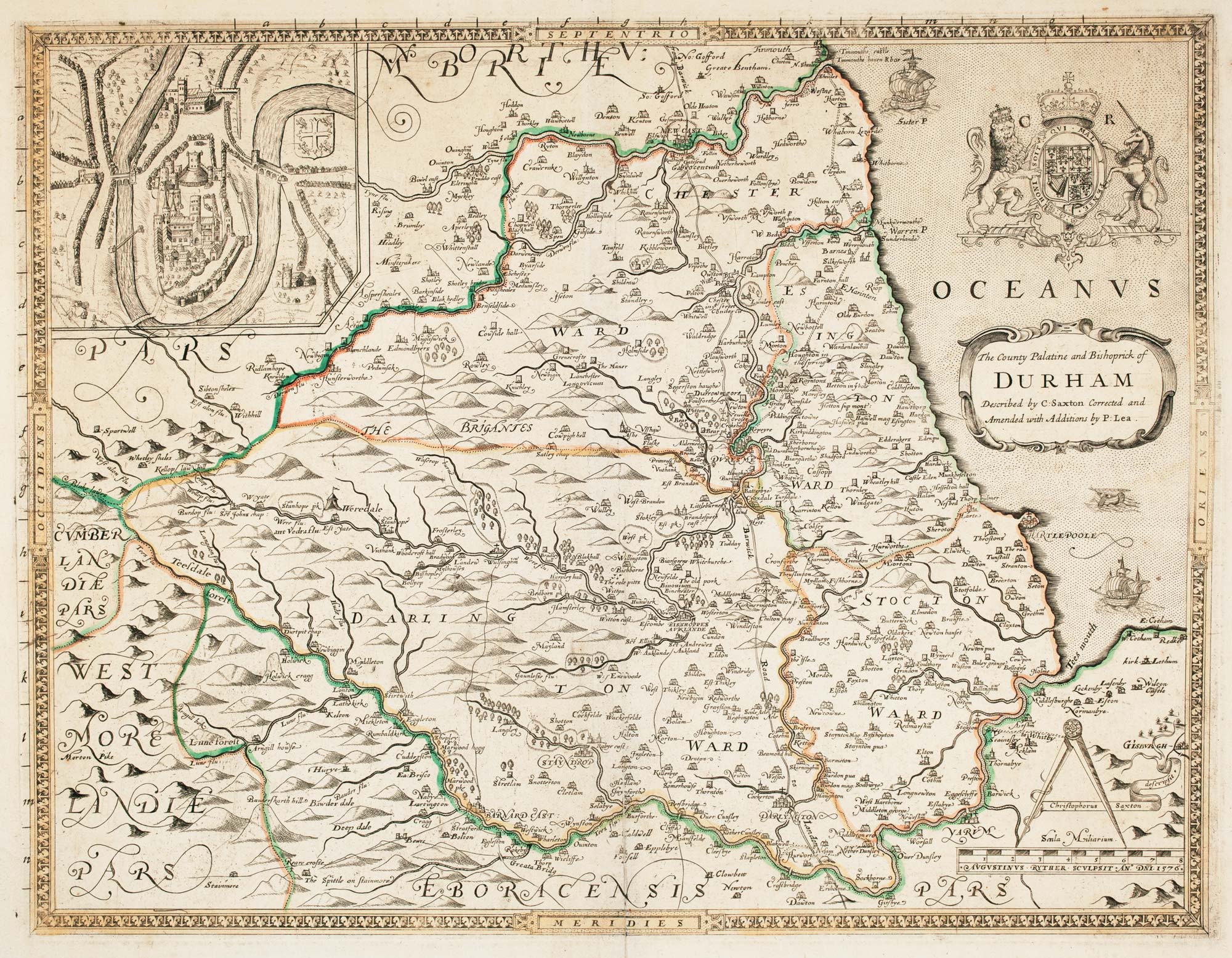
Saxton's map of Durham as revised by Philip Lea
SAXTON, Christopher. Date: 1694 Stock #: 22702 £1,250.00
Add to Wishlist
Add to Wishlist

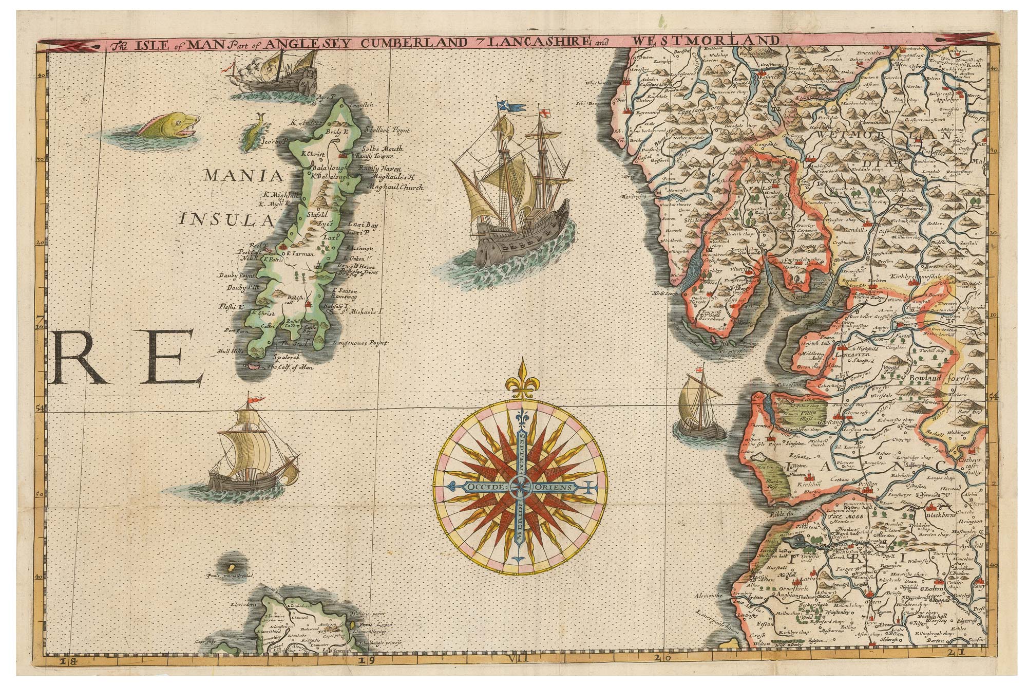
An unrecorded state of Saxton's map of South East England
SAXTON, Christopher. Date: 1690 Stock #: 22260 £3,000.00
Add to Wishlist
Add to Wishlist
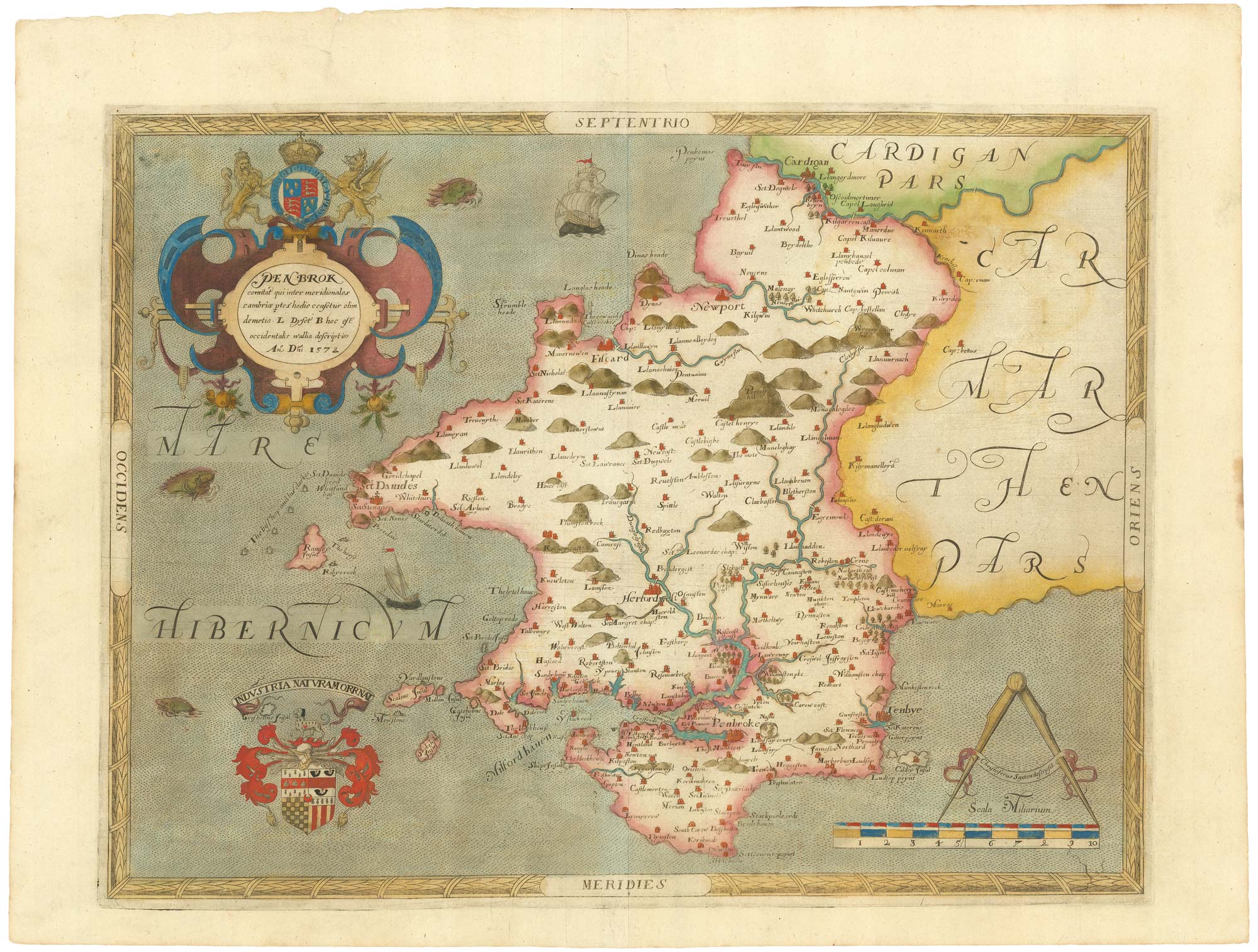
The first printed map of Pembrokeshire
SAXTON, Christopher. Date: 1579 Stock #: 21868 £3,500.00
Add to Wishlist
Add to Wishlist