Antique Maps by MOUCHEZ, Amédée Ernest Barthémy.

Showing 1–2 of 2 products
Sort by:
Add to Wishlist
Add to Wishlist
12509

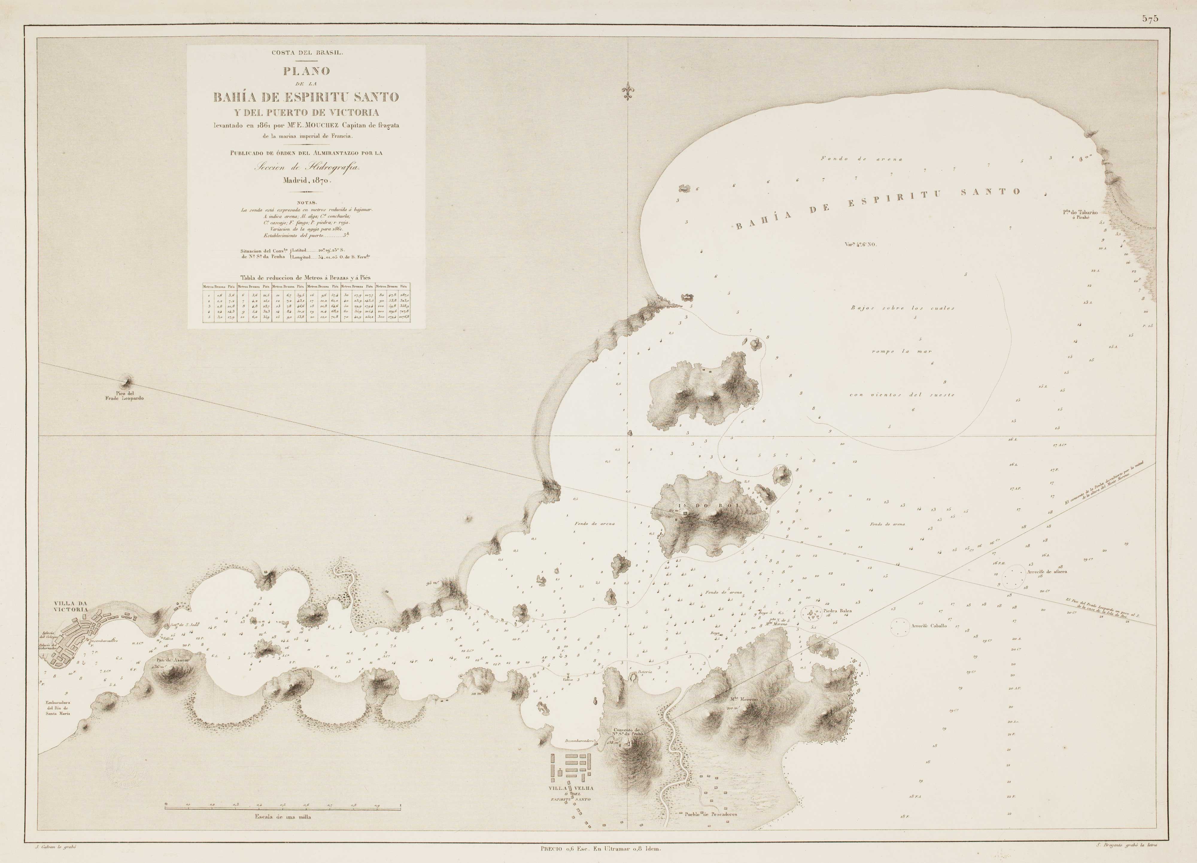
Sea chart of Espiritu Santo

MOUCHEZ, Amédée Ernest Barthémy. Date: 1870 Stock #: 12509 £300.00
Add to Wishlist
Add to Wishlist
Illustration of a detailed 19th century Spanish sea chart showing the north coast of Bahia de Samaná in the Dominican Republic

An uncommon 19th century Spanish sea chart of the Dominican Republic

MOUCHEZ, Amédée Ernest Barthémy. Date: 1865 Stock #: 11846 £100.00