Antique Maps by COLLINS, Greenvile.
Showing 1–4 of 4 products
Sort by:
Add to Wishlist
Add to Wishlist
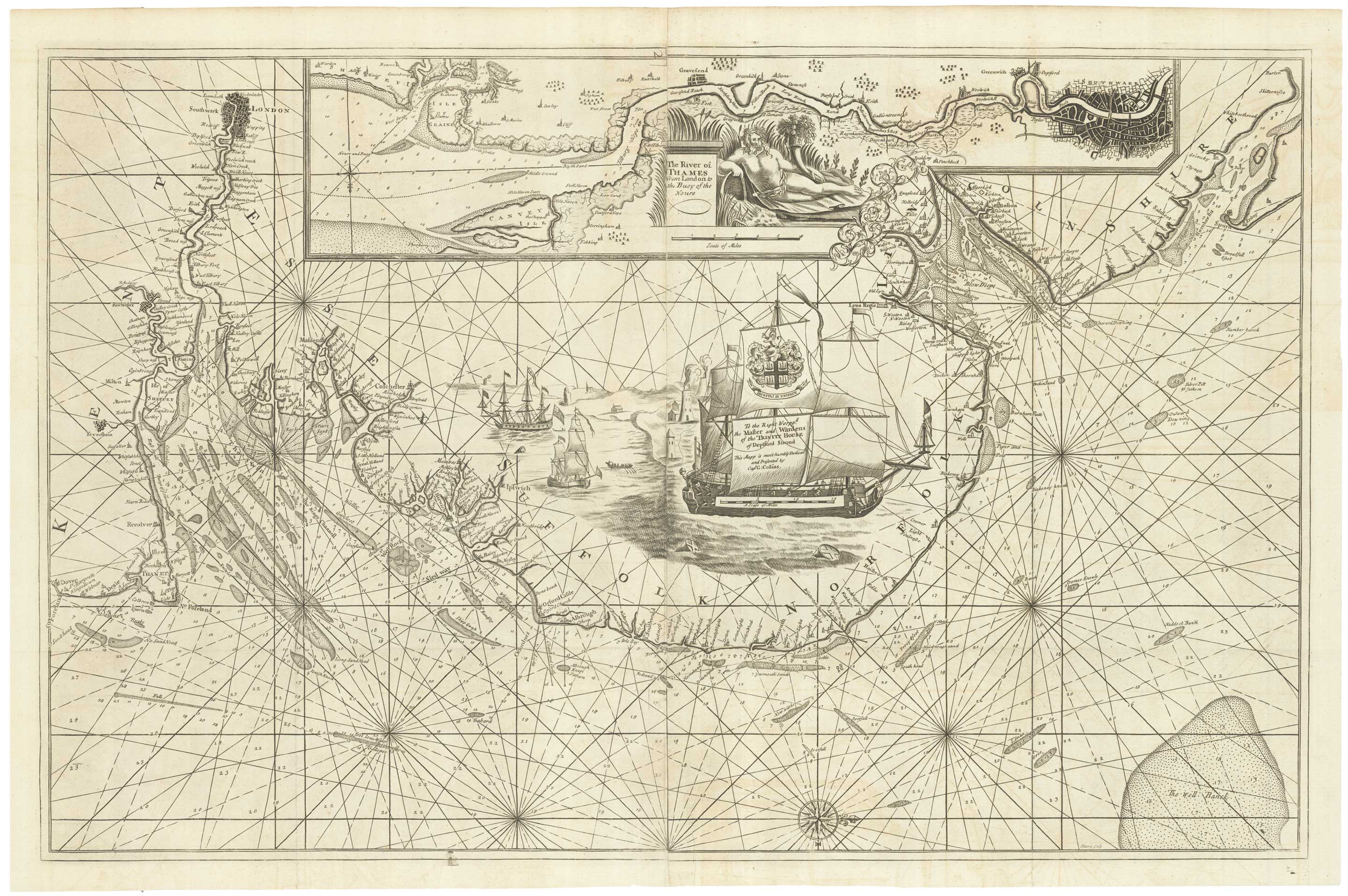
An English 17th century sea-chart of Dover to Spurn Head with the River Thames
COLLINS, Greenvile. Date: 1740 Stock #: 25078 £1,500.00
Add to Wishlist
Add to Wishlist
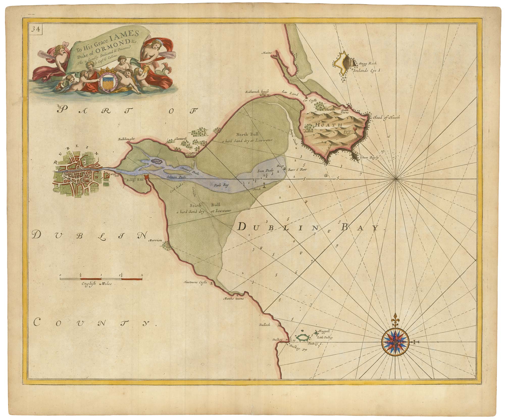
Sea chart of Dublin Bay from the first English sea-atlas
COLLINS, Greenvile. Date: 1693 Stock #: 23156 £550.00
Add to Wishlist
Add to Wishlist
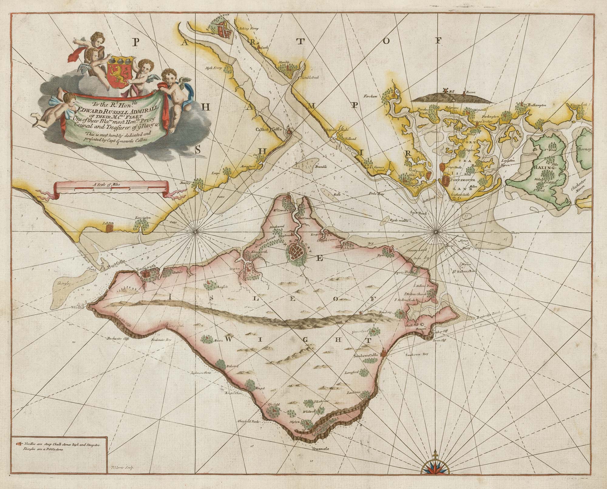
Sea chart of the Isle of Wight from the first English sea-atlas
COLLINS, Greenvile. Date: 1693 Stock #: 21703 £650.00
Add to Wishlist
Add to Wishlist