Antique Maps by CHATELAIN, Henri Abraham.
Showing 1–11 of 11 products
Sort by:
Add to Wishlist
Add to Wishlist
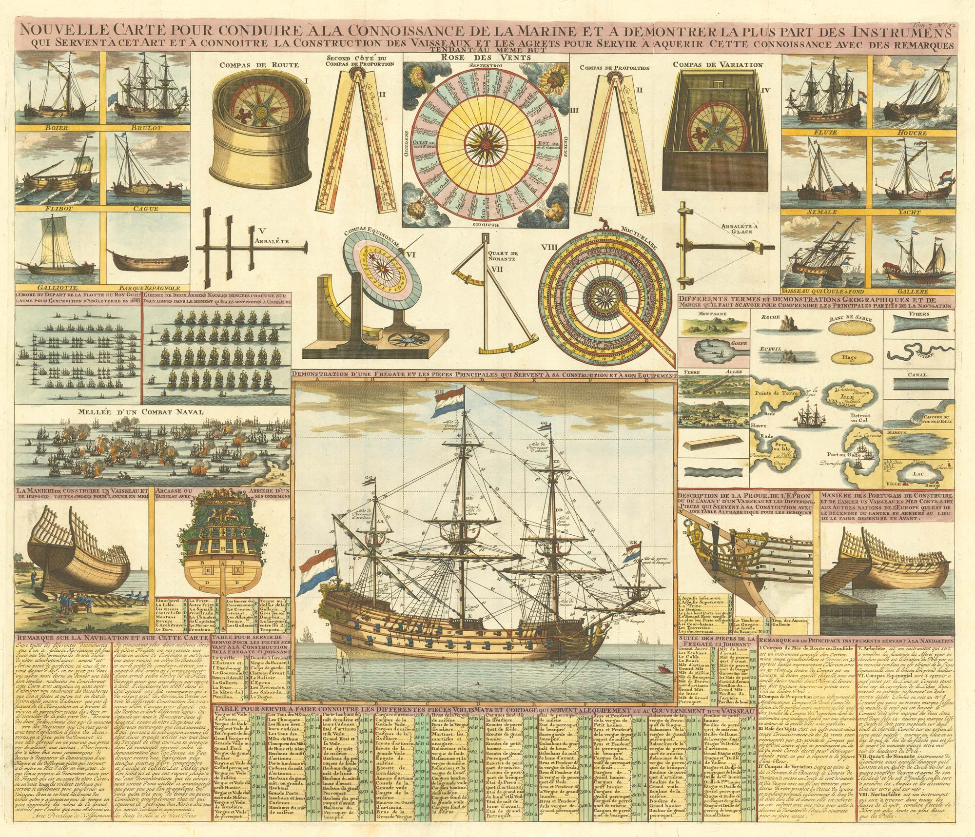
An 18th century maritime explanatory print
CHATELAIN, Henri Abraham. Date: 1720 Stock #: 24154 £1,200.00
Add to Wishlist
Add to Wishlist
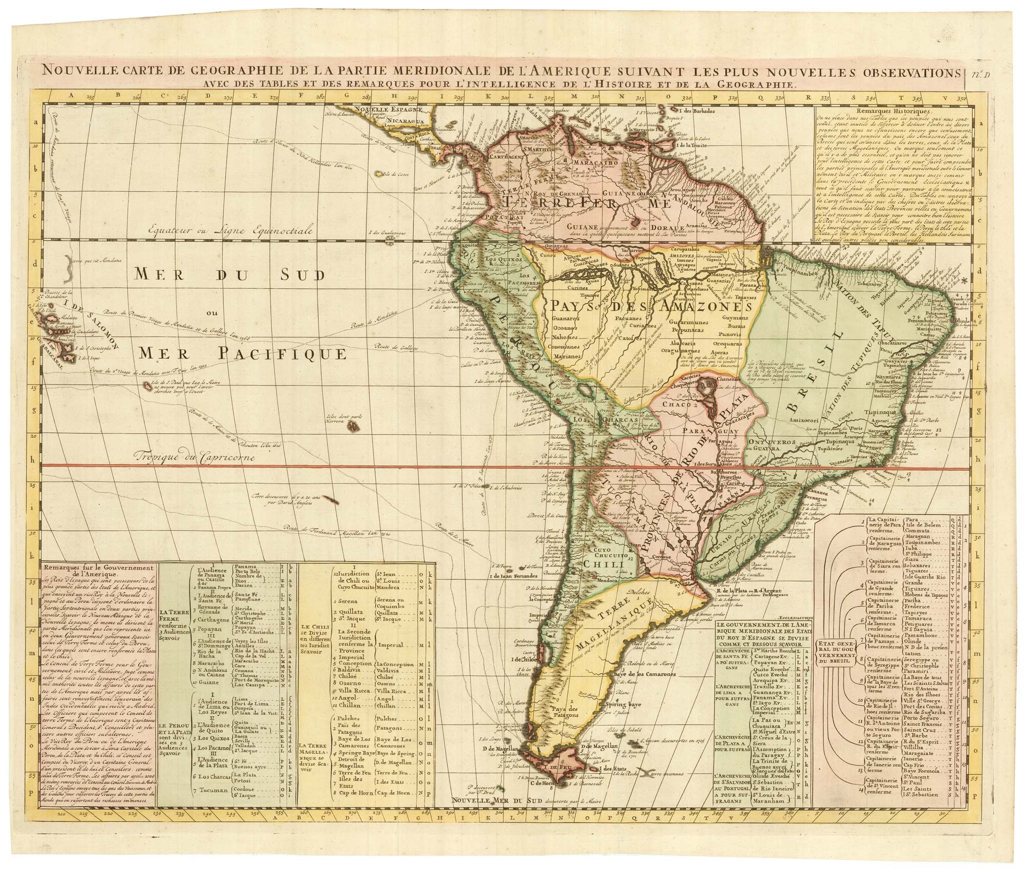
An 18th century map of South America
CHATELAIN, Henri Abraham. Date: 1747 Stock #: 23261 £480.00
Add to Wishlist
Add to Wishlist
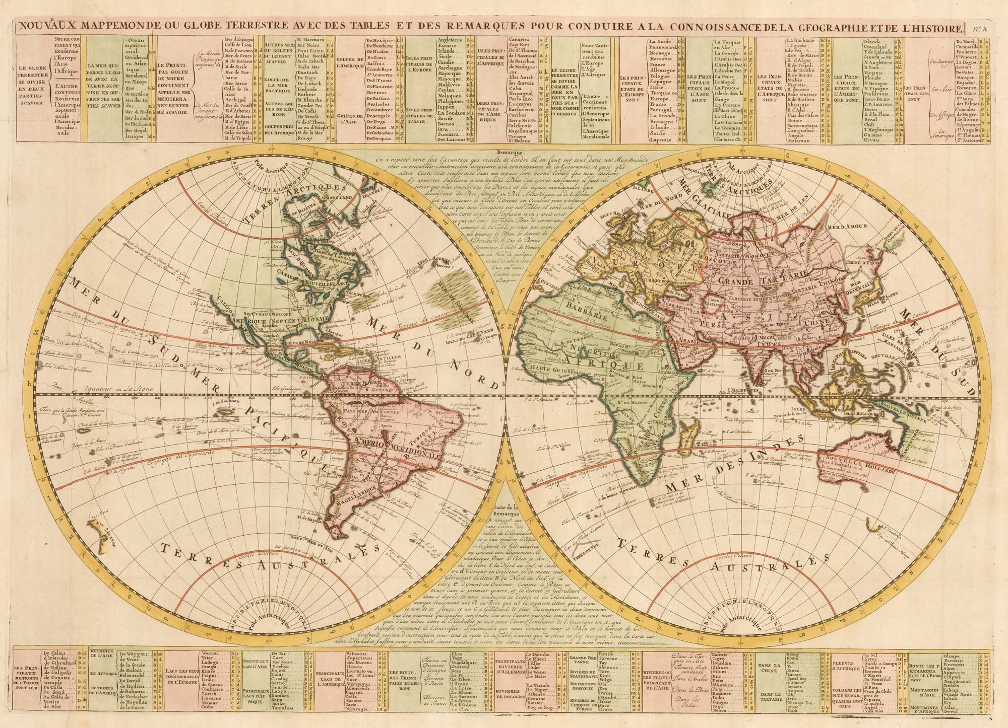
An 18th century double-hemisphere world map
CHATELAIN, Henri Abraham. Date: 1747 Stock #: 23390 £1,000.00
Add to Wishlist
Add to Wishlist
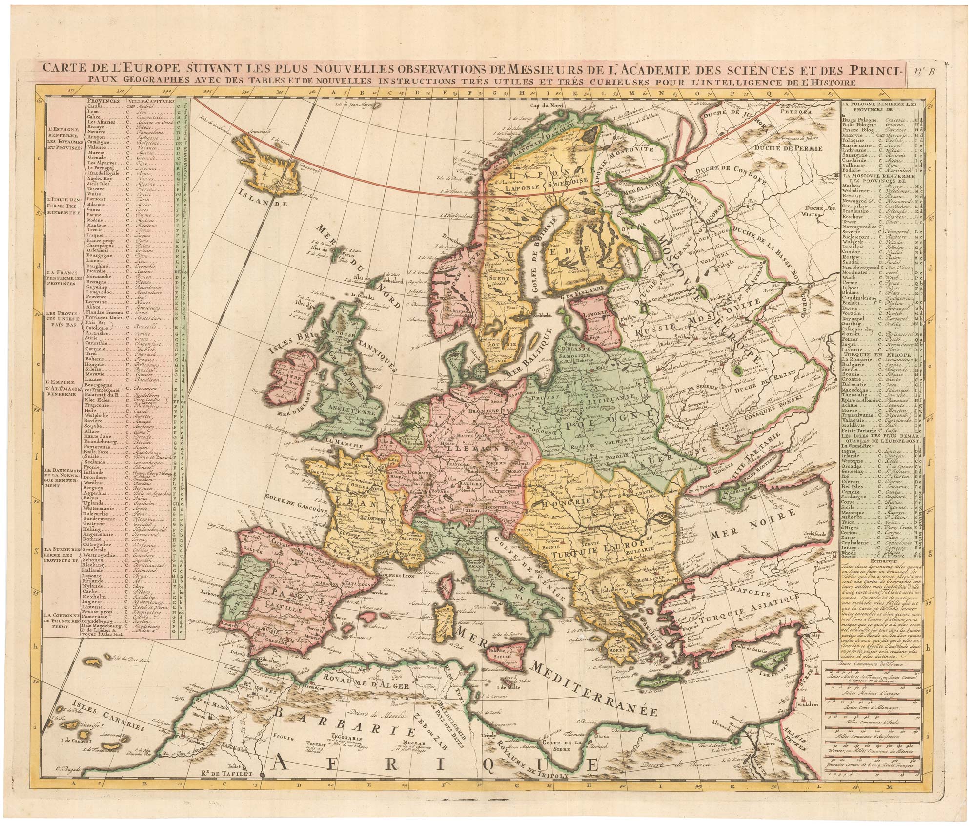
An 18th century map of Europe
CHATELAIN, Henri Abraham. Date: 1747 Stock #: 23391 £500.00
Add to Wishlist
Add to Wishlist
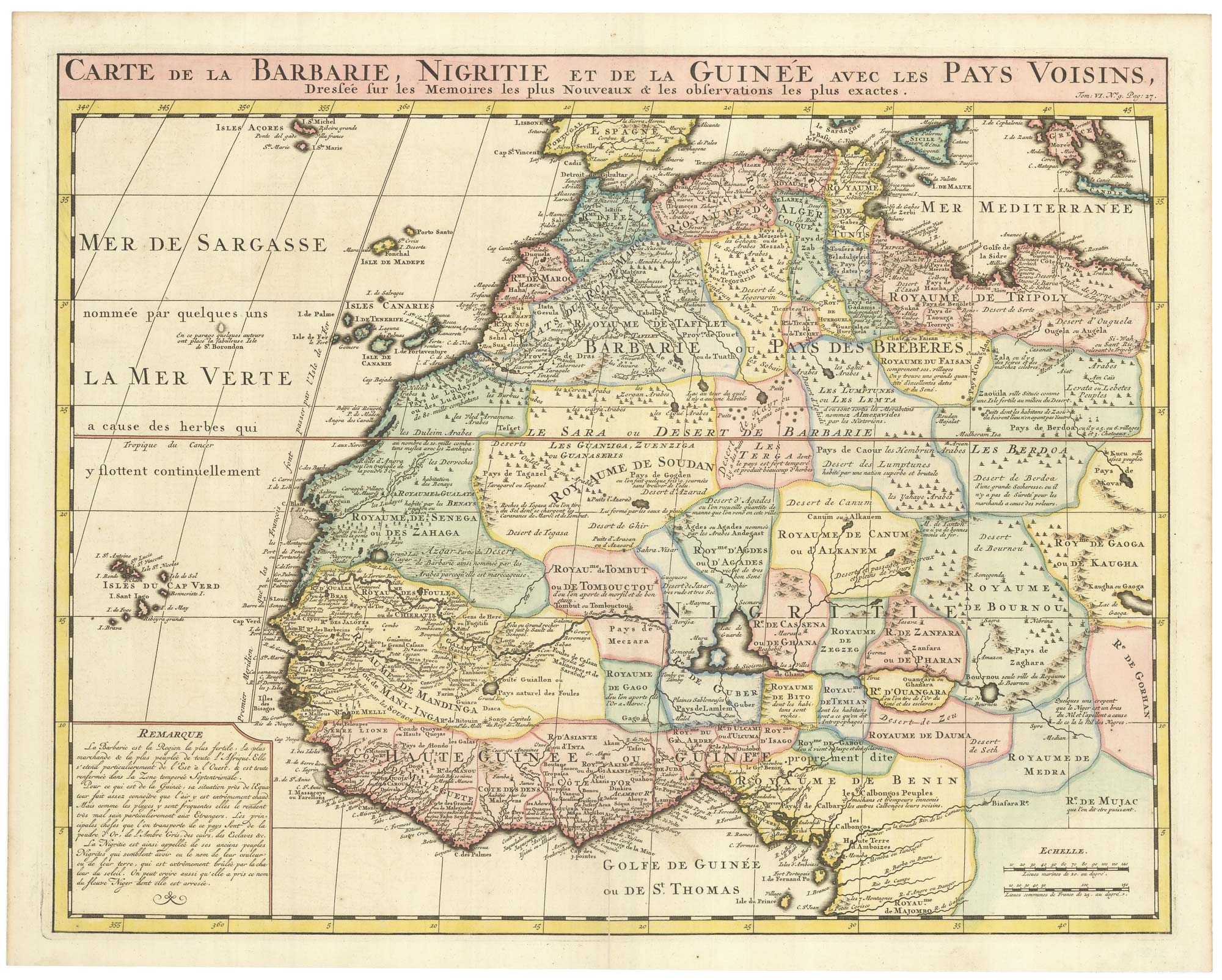
An 18th century map of Northwest Africa
CHATELAIN, Henri Abraham. Date: 1720 Stock #: 22881 £340.00
Add to Wishlist
Add to Wishlist
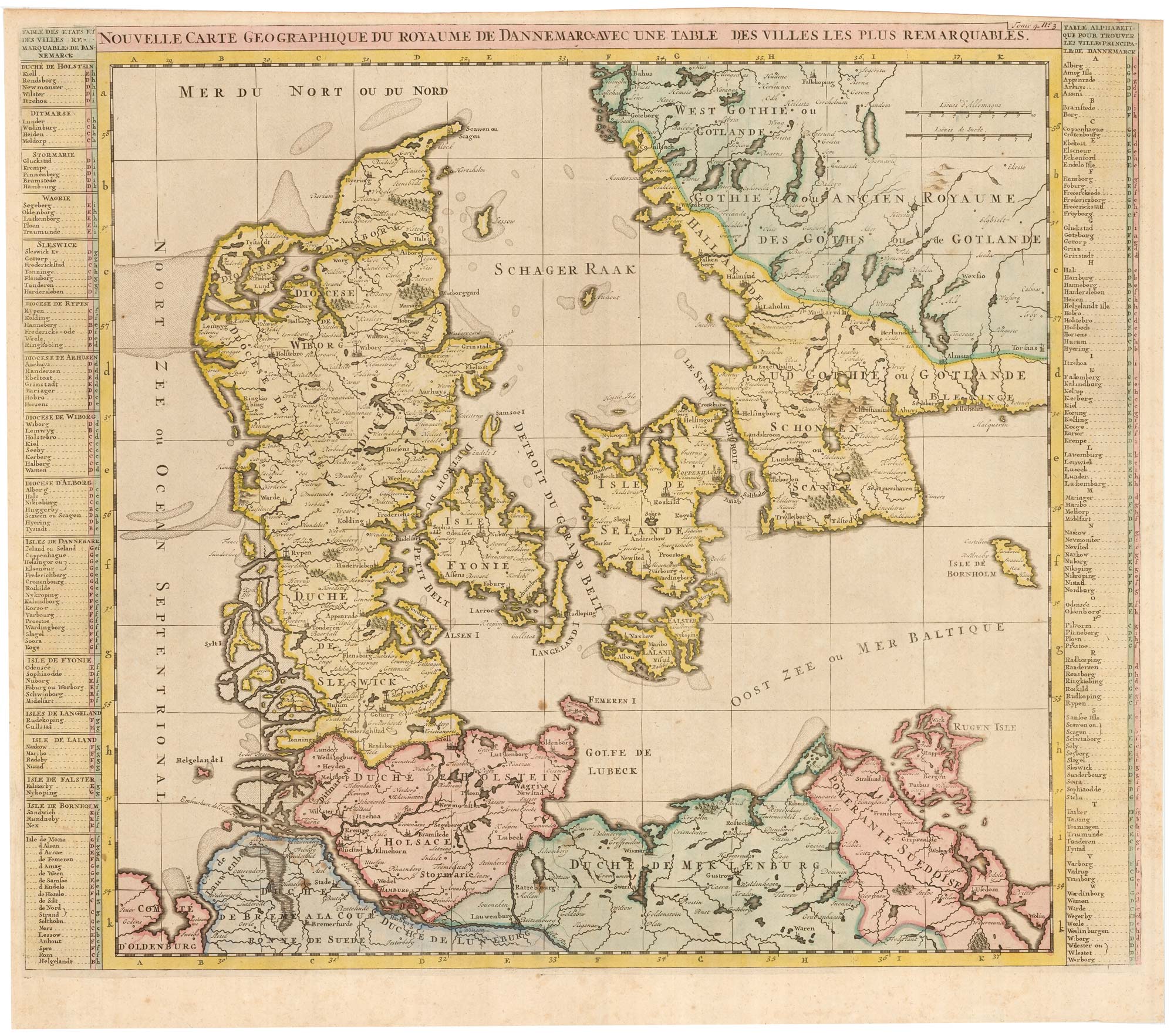
An early 18th century map of Denmark
CHATELAIN, Henri Abraham. Date: 1719 Stock #: 22887 £320.00
Add to Wishlist
Add to Wishlist
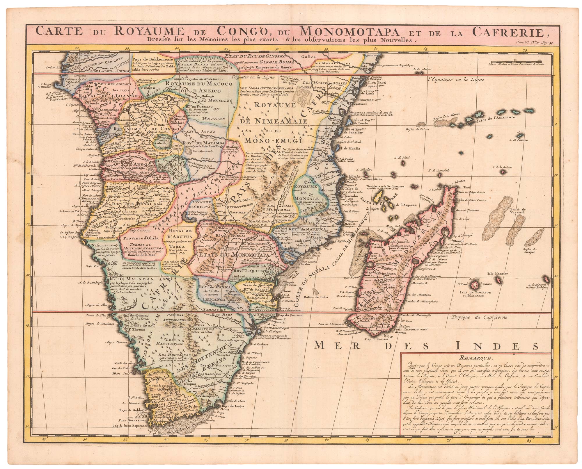
An 18th century map of Africa below the Equator
CHATELAIN, Henri Abraham. Date: 1720 Stock #: 22880 £380.00
Add to Wishlist
Add to Wishlist

A map of North America during the Mississippi Bubble
CHATELAIN, Henri Abraham. Date: 1747 Stock #: 22751 £2,400.00
Add to Wishlist
Add to Wishlist
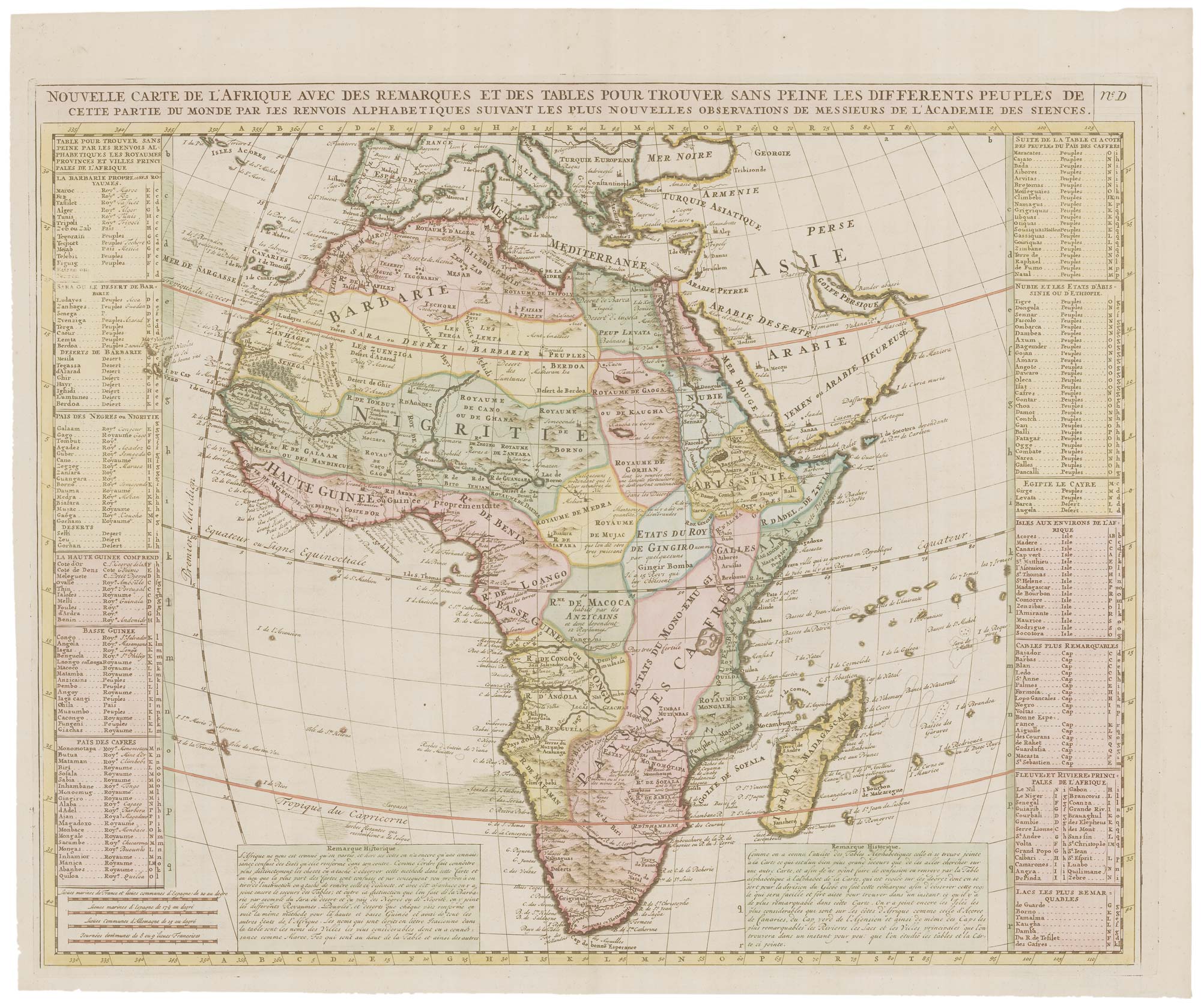
18th century map of Africa
CHATELAIN, Henri Abraham. Date: 1721 Stock #: 22177 £450.00
Add to Wishlist
Add to Wishlist
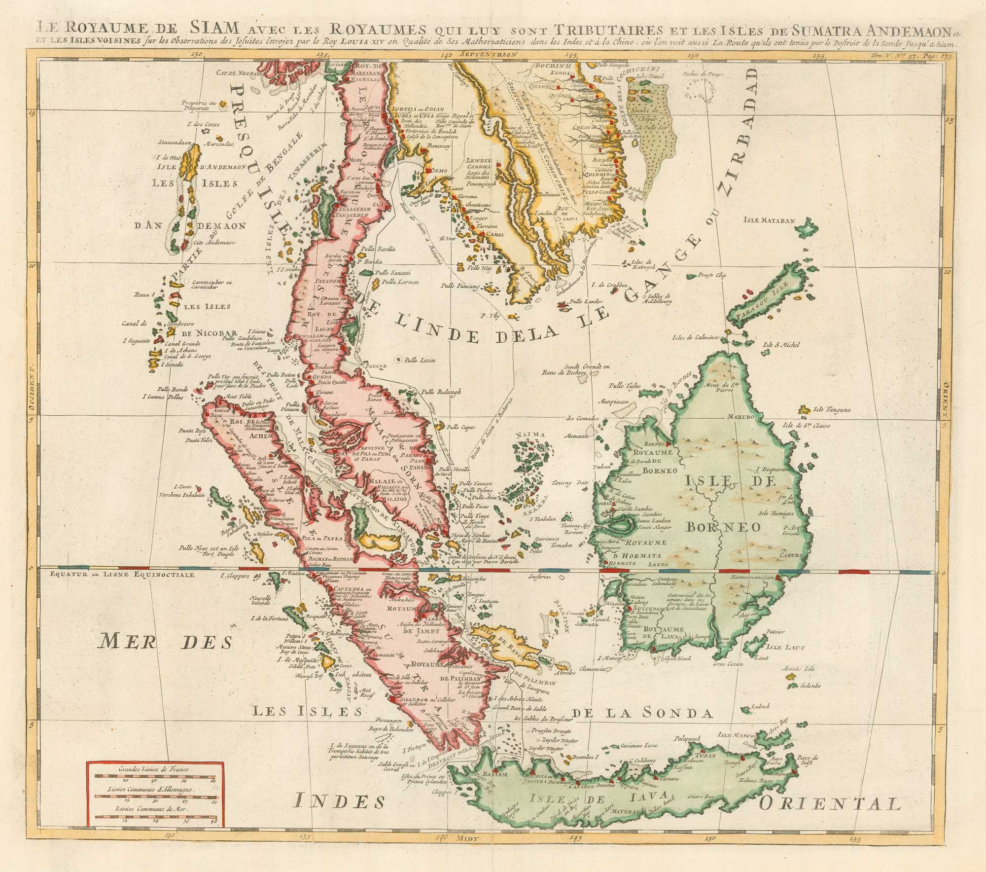
18th century map of the Malay Peninsula and Indonesia
CHATELAIN, Henri Abraham. Date: 1719 Stock #: 19983 £600.00
Add to Wishlist
Add to Wishlist