Antique Maps by BLAEU, Johannes.
Showing 31–44 of 44 products
Sort by:
Add to Wishlist
Add to Wishlist
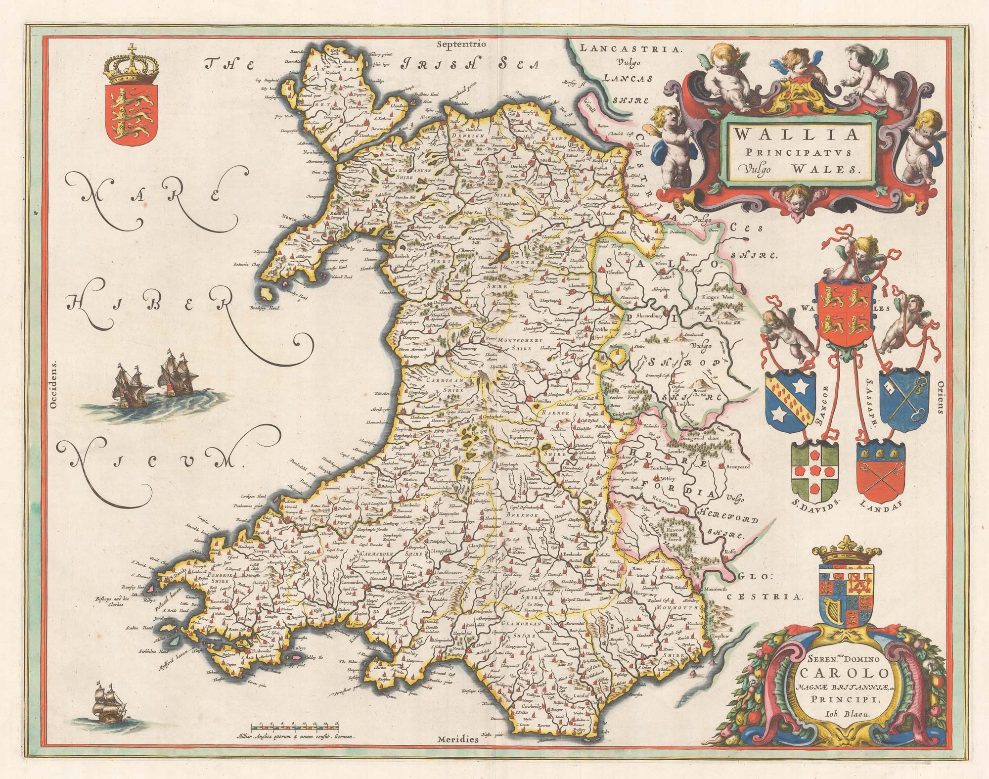
An early issue of Blaeu's map of Wales, with fine colour
BLAEU, Johannes. Date: 1645 Stock #: 22266 £950.00
Add to Wishlist
Add to Wishlist

The province Zhili from the first European atlas of China
BLAEU, Johannes. Date: 1655 Stock #: 21962 £2,800.00
Add to Wishlist
Add to Wishlist
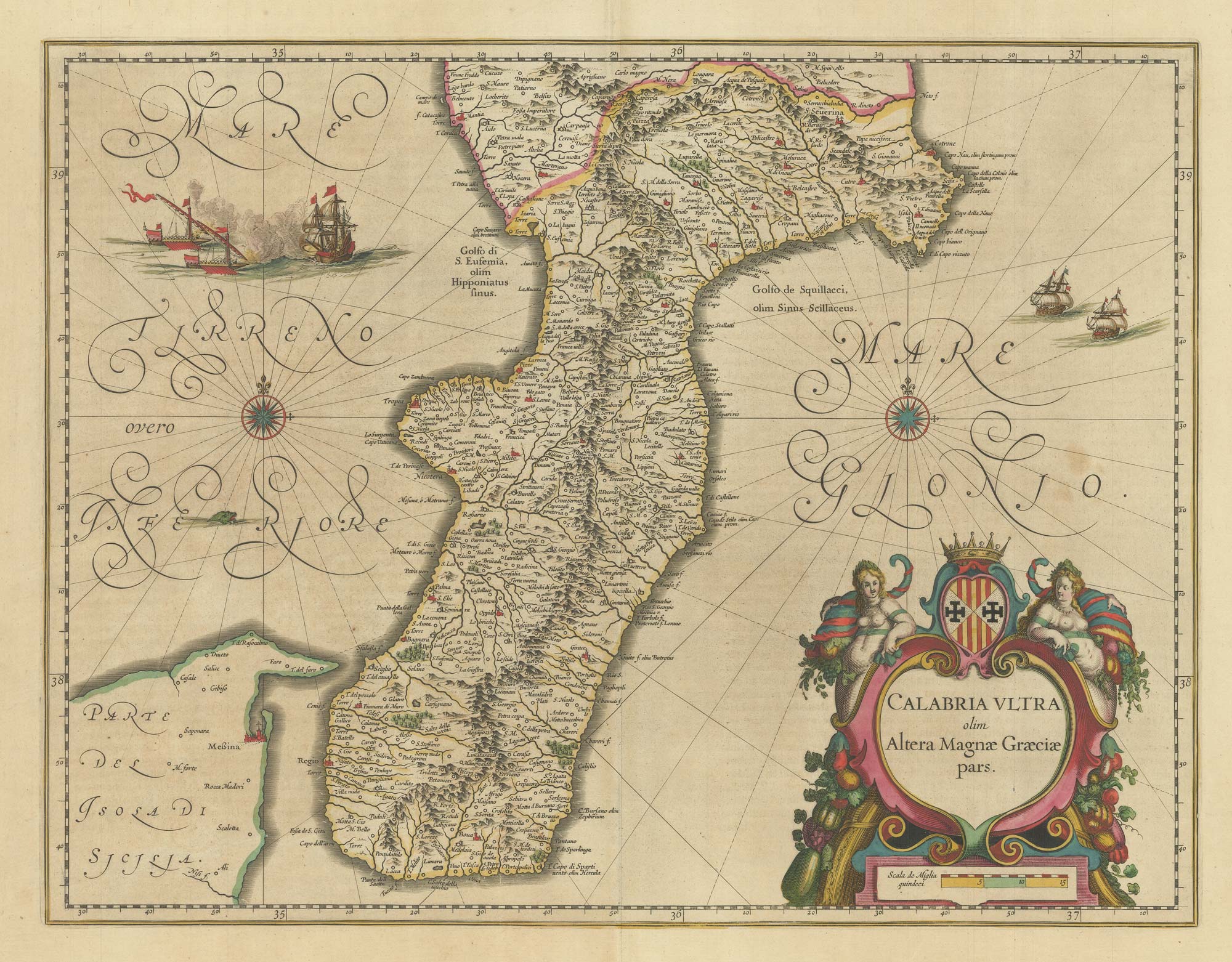
A 17th century map of Calabria
BLAEU, Johannes. Date: 1717 Stock #: 21965 £440.00
Add to Wishlist
Add to Wishlist

An early townplan of Oneglia in Liguria
BLAEU, Johannes. Date: 1725 Stock #: 20547 £900.00
Add to Wishlist
Add to Wishlist
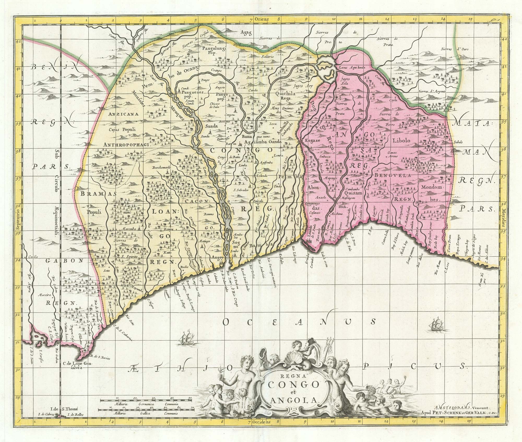
Uncommon map of Congo and Angola
BLAEU, Johannes. Date: 1705 Stock #: 20514 £280.00
Add to Wishlist
Add to Wishlist

The first Western atlas of China
BLAEU, Johannes. Date: 1655 Stock #: 20044 £29,000.00
Add to Wishlist
Add to Wishlist
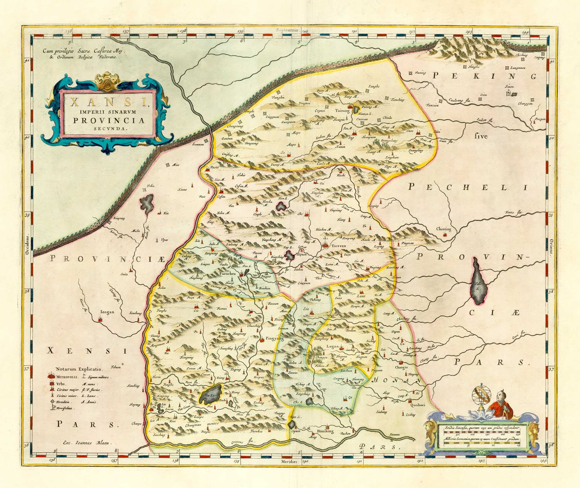
The first western map of the Chinese province of Shanxi
BLAEU, Johannes. Date: 1658 Stock #: 18173 £750.00
Add to Wishlist
Add to Wishlist

The first western map of the Chinese province of Shandong
BLAEU, Johannes. Date: 1658 Stock #: 18174 £1,200.00
Add to Wishlist
Add to Wishlist
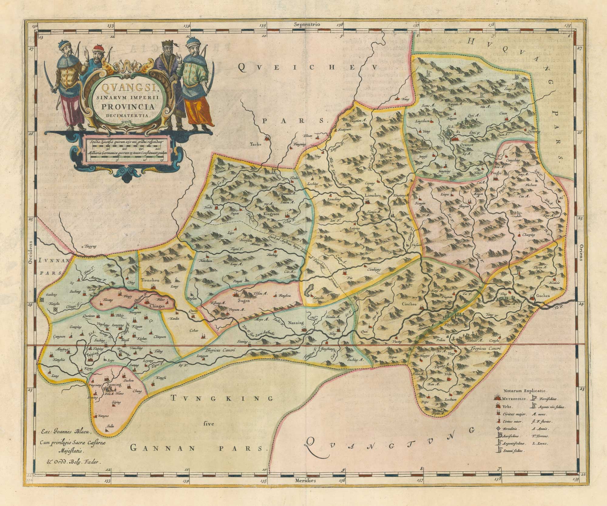
The first western map of the Chinese province of Guangxi
BLAEU, Johannes. Date: 1658 Stock #: 18177 £850.00
Add to Wishlist
Add to Wishlist

16th century map of Cheshire from the Duke of York's Library
BLAEU, Johannes. Date: 1648 Stock #: 15535 £460.00
Add to Wishlist
Add to Wishlist
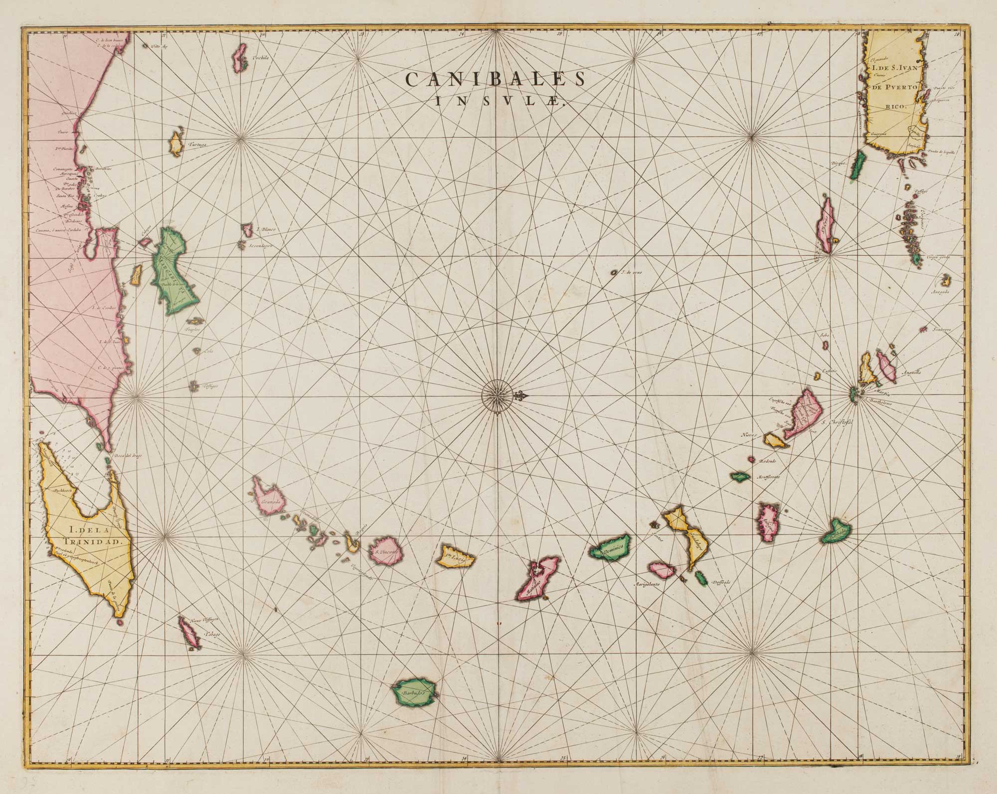
17th century chart of the Lesser Antilles
BLAEU, Johannes. Date: 1662 Stock #: 15193 £850.00
Add to Wishlist
Add to Wishlist

Map of Nottinghamshire published during the English Civil War
BLAEU, Johannes. Date: 1648 Stock #: 14532 £500.00
Add to Wishlist
Add to Wishlist
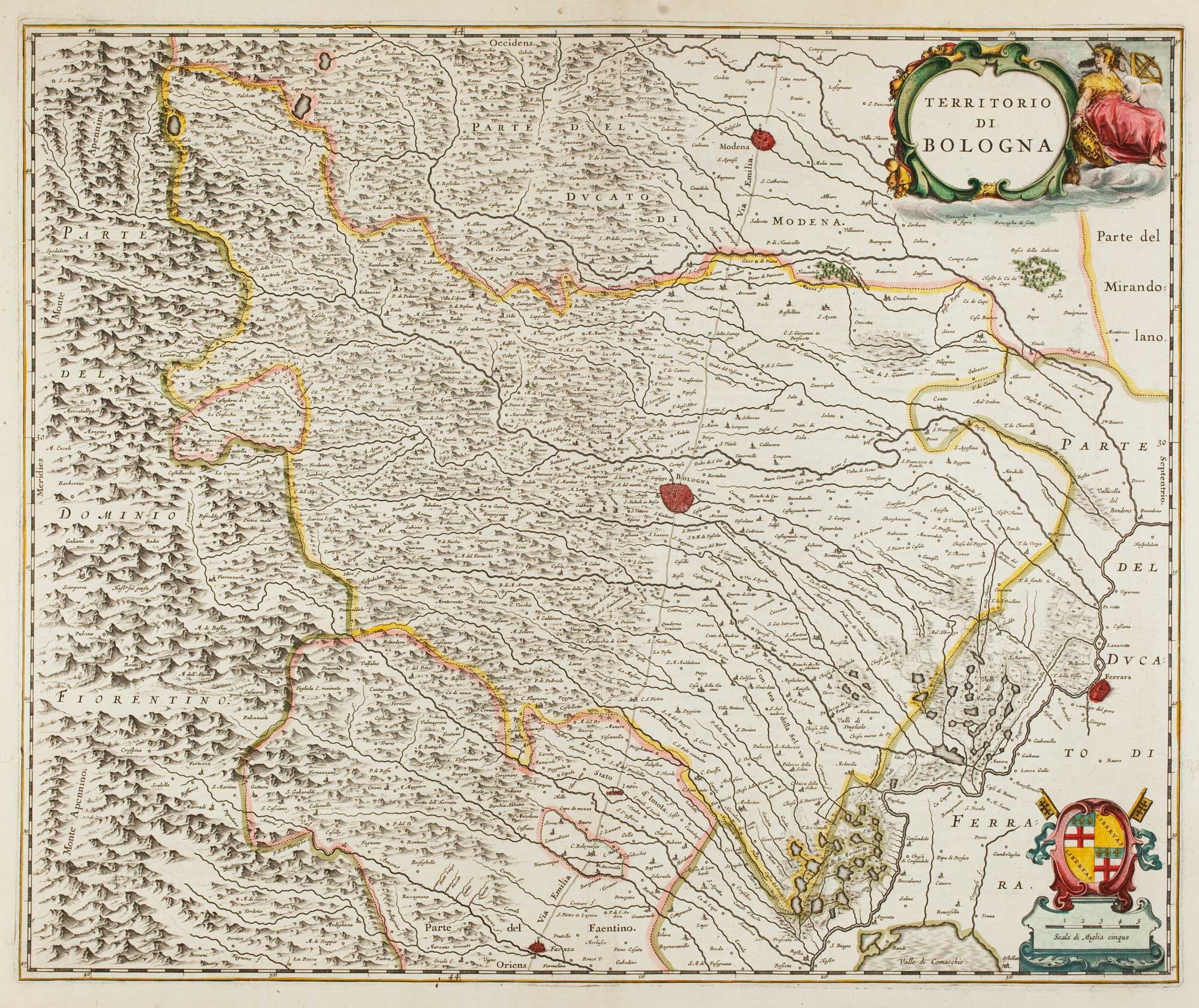
17th century map of Emilia Romagna
BLAEU, Johannes. Date: 1640 Stock #: 12048 £225.00
Add to Wishlist
Add to Wishlist
